Category:M-29 (Michigan highway)
Jump to navigation
Jump to search
 | number: | (twenty-nine) |
|---|---|---|
| State highways in Michigan: | 10 · 11 · 13 · 14 · 15 · 17 · 18 · 19 · 20 · 21 · 22 · 24 · 25 · 26 · 27 · 28 · 29 · 30 · 32 · 33 · 34 · 35 · 36 · 37 · 38 · 39 · 40 · 42 · 43 · 44 · 45 · 46 · 47 · 48 · 49 |
highway in Michigan, United States  | |||||
| Upload media | |||||
| Instance of | |||||
|---|---|---|---|---|---|
| Location | Michigan | ||||
| Transport network | |||||
| Owned by | |||||
| Maintained by | |||||
| Inception |
| ||||
| Length |
| ||||
| |||||
Media in category "M-29 (Michigan highway)"
The following 12 files are in this category, out of 12 total.
-
 Algonac State Park 3.jpg 5,179 × 2,913; 2.5 MB
-
 Algonac, MI road signage.jpg 5,179 × 2,914; 2.69 MB
-
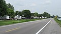
 Algonac, Michigan (August 2023).jpg 5,179 × 2,913; 2.42 MB
-
 Algonac, Michigan.jpg 5,312 × 2,988; 6.49 MB
-
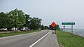
 Anchorville, Michigan road signage.jpg 5,180 × 2,913; 3.06 MB
-
 Fair Haven, Michigan road signage.jpg 5,179 × 2,914; 2.59 MB
-
 M-154 signage toward Harsens Island.jpg 5,179 × 2,913; 3.05 MB
-
 M-29 1926.svg 600 × 600; 30 KB
-
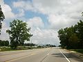 M-29 in Chesterfield Township.jpg 3,264 × 2,448; 3.61 MB
-
 Pearl Beach (St. Clair County), MI road signage.jpg 5,179 × 2,913; 3.26 MB
-
 Roberts Landing, Michigan road signage.jpg 4,581 × 2,576; 2.05 MB
-
 U.S. Bicycle Route 20 road signage (Algonac, MI).jpg 5,179 × 2,914; 3.71 MB


.jpg)


,_MI_road_signage.jpg)

.jpg)