Category:Maleborduurstraat 7, Wijk bij Duurstede
Jump to navigation
Jump to search
| Object location | | View all coordinates using: OpenStreetMap |
|---|
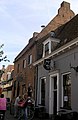
house in Wijk bij Duurstede, Netherlands  | |||||
| Upload media | |||||
| Instance of | |||||
|---|---|---|---|---|---|
| Location | Wijk bij Duurstede, Utrecht, Netherlands | ||||
| Street address |
| ||||
| Located on street |
| ||||
| Heritage designation |
| ||||
 | |||||
|
This is a category about rijksmonument number 39687
|
| Address |
|
Media in category "Maleborduurstraat 7, Wijk bij Duurstede"
The following 11 files are in this category, out of 11 total.
-
 Achtergevel - Wijk bij Duurstede - 20213381 - RCE.jpg 1,200 × 953; 290 KB
-
 Interieur overzicht restaurant - Wijk bij Duurstede - 20213382 - RCE.jpg 1,200 × 960; 156 KB
-
 Interieur restaurant - Wijk bij Duurstede - 20213383 - RCE.jpg 1,200 × 961; 147 KB
-
 Maleborduurstr 7 Mon 39687.jpg 1,712 × 2,288; 1.16 MB
-
 Maleborduurstraat 7 39687.jpg 1,712 × 2,288; 1.33 MB
-
 Voorgevel - Wijk bij Duurstede - 20213377 - RCE.jpg 823 × 1,200; 176 KB
-
 Voorgevel - Wijk bij Duurstede - 20213380 - RCE.jpg 956 × 1,200; 219 KB
-
 Voorgevels - Wijk bij Duurstede - 20213379 - RCE.jpg 1,200 × 970; 240 KB
-
 WbD EF Maleborduurstr nr 7 RM 39687.JPG 1,712 × 2,288; 1.27 MB
-
 WbD Monumenten Maleborduurstr 7 RM 39688.JPG 1,712 × 2,288; 1.2 MB
-
 WbD Monumenten Met li Maleborduurstr 7 RM 39688.JPG 1,366 × 2,094; 729 KB


