Category:Mallwyd
Jump to navigation
Jump to search
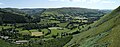
Cymraeg: Pentref bychan a phlwyf yn ne-ddwyrain Gwynedd yw Mallwyd. Fe'i lleolir yn nyffryn Afon Dyfi ar lôn priffordd yr A470 tua hanner ffordd rhwng Dolgellau a Machynlleth. Ar bwys y pentref mae cyffordd yr A458 o gyfeiriad Y Trallwng. Y pentrefi agosach yw Dinas Mawddwy, tua dwy filltir i'r gogledd, ac Aberangell i'r de. Mae Afon Dugoed yn aberu yn Afon Dyfi ger y pentref.
English: Mallwyd is a small village at the most southern end of the county of Gwynedd in North Wales in the valley of the River Dyfi. It lies on the A470 approximately half-way between Dolgellau and Machynlleth, and forms the junction of the A458 towards Welshpool. The nearest village is Dinas Mawddwy, two miles to the north, and Aberangell to the south. The River Dugoed flows into the River Dyfi near the village.
village in Wales  | |||||
| Upload media | |||||
| Instance of | |||||
|---|---|---|---|---|---|
| Location | Gwynedd, Wales | ||||
 | |||||
Subcategories
This category has the following 2 subcategories, out of 2 total.
P
- Pont Minllyn (7 F)
T
- St Tydecho's Church, Mallwyd (98 F)
Media in category "Mallwyd"
The following 83 files are in this category, out of 83 total.
-
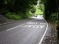 A458 (T) on a rainy Bank Holiday - geograph.org.uk - 449347.jpg 640 × 480; 150 KB
-
 A470 - geograph.org.uk - 601199.jpg 480 × 640; 127 KB
-
 At Mallwyd.jpeg 900 × 674; 357 KB
-
 Brigand's Inn Coaching Inn (8062086162).jpg 1,280 × 960; 965 KB
-
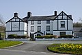 Brigands Inn.jpg 4,000 × 2,672; 6.02 MB
-
 Craig For - geograph.org.uk - 30905.jpg 449 × 294; 22 KB
-
 Early postcard of Mallwyd village back.jpg 816 × 516; 293 KB
-
 Early postcard of Mallwyd village.jpg 1,628 × 1,032; 1.6 MB
-
 Eglwys Sant Tydecho Mallwyd Powys Cymru Wales 07.JPG 4,272 × 2,848; 4.49 MB
-
 Esgair Ddu - geograph.org.uk - 30908.jpg 451 × 297; 24 KB
-
 Foel Dugeod - geograph.org.uk - 601169.jpg 640 × 480; 92 KB
-

-
 Hay making in the Dyfi Valley near Mallwyd.jpg 4,780 × 1,865; 4.27 MB
-
 Lane down from A470 - geograph.org.uk - 601203.jpg 480 × 640; 173 KB
-
 Mallwyd - geograph.org.uk - 2202.jpg 640 × 425; 32 KB
-
 Mallwyd Bridge, N. W.jpeg 900 × 634; 446 KB
-
 Mallwyd Brigands Inn - 2007-03-03.jpg 2,592 × 1,944; 1.95 MB
-
 Mallwyd waterfalls - 2006-10-28.jpg 2,592 × 1,944; 2.21 MB
-
 Mallwyd, Merionethshire.jpeg 900 × 727; 378 KB
-
 Meirion Mill shop - geograph.org.uk - 223862.jpg 640 × 427; 70 KB
-

-
 Temptation^ - geograph.org.uk - 601163.jpg 640 × 480; 151 KB
-

-

-

-
 A view to the east from Mynydd y Cemais - geograph.org.uk - 1094038.jpg 640 × 480; 152 KB
-
 A view towards Llechwedd Mawr - geograph.org.uk - 1097013.jpg 640 × 480; 207 KB
-

-

-
 Afon Dyfi at Mallwyd - geograph.org.uk - 750760.jpg 640 × 480; 134 KB
-
 Afon Dyfi near Mallwyd - geograph.org.uk - 669498.jpg 640 × 427; 74 KB
-
 Afon Dyfi near Mynllyn - geograph.org.uk - 1425155.jpg 640 × 480; 93 KB
-
 Approaching the forestry at Waun Llinau - geograph.org.uk - 1097010.jpg 640 × 480; 203 KB
-
 Barn, Braich-llwyd - geograph.org.uk - 600916.jpg 640 × 480; 113 KB
-
 Bend on A458(T) - geograph.org.uk - 600939.jpg 640 × 480; 96 KB
-
 Blaen-y-cwm - geograph.org.uk - 1491694.jpg 640 × 426; 95 KB
-
 Blaentafalog Farm - geograph.org.uk - 520720.jpg 480 × 640; 274 KB
-
 Brigands inn. - geograph.org.uk - 214696.jpg 640 × 480; 144 KB
-
 Bwlch Siglen - geograph.org.uk - 57671.jpg 640 × 480; 112 KB
-
 Bwlch Siglen looking south - geograph.org.uk - 647026.jpg 640 × 480; 77 KB
-
 Cottage, Cwm-Cewydd - geograph.org.uk - 454347.jpg 640 × 480; 158 KB
-
 Cwm Bychan - geograph.org.uk - 104590.jpg 640 × 184; 43 KB
-
 Cwm Tafolog - geograph.org.uk - 520724.jpg 640 × 480; 238 KB
-
 Digger on Welsh Hillside - geograph.org.uk - 600918.jpg 640 × 480; 132 KB
-
 Farmhouse off A458(T) - geograph.org.uk - 449358.jpg 640 × 480; 132 KB
-
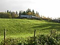
 Farmland near Nant-hir - geograph.org.uk - 520709.jpg 640 × 480; 320 KB
-
 Ford over Afon Clywedog - geograph.org.uk - 601060.jpg 640 × 480; 138 KB
-
 Gate from the forest - geograph.org.uk - 601046.jpg 640 × 480; 129 KB
-
 Gate into the forest - geograph.org.uk - 601049.jpg 640 × 480; 163 KB
-
 Gateway to Forest Track off A458(T) - geograph.org.uk - 449353.jpg 640 × 480; 141 KB
-
 Gelli-dolen, Cwm Clywedog - geograph.org.uk - 601165.jpg 640 × 480; 132 KB
-
 Goose, Cwm-Cewydd - geograph.org.uk - 454272.jpg 640 × 480; 157 KB
-
 Gwynedd-Powys boundary A458 - geograph.org.uk - 601007.jpg 640 × 480; 78 KB
-
 Hidden house - geograph.org.uk - 601205.jpg 640 × 480; 116 KB
-
 Hillside above Afon Dugeod - geograph.org.uk - 600985.jpg 640 × 480; 98 KB
-
 Hillside from Braich-llwyd - geograph.org.uk - 600925.jpg 640 × 480; 118 KB
-
 Hillside near Ty-mawr farm - geograph.org.uk - 601202.jpg 640 × 480; 123 KB
-
 Hillside, Cwm Dugeod - geograph.org.uk - 601006.jpg 640 × 480; 106 KB
-
 Hillside, Mynydd Clywedog - geograph.org.uk - 601139.jpg 640 × 480; 158 KB
-
 House next to A458 - geograph.org.uk - 449370.jpg 640 × 480; 169 KB
-
 House overlooking Dovey Valley - geograph.org.uk - 750761.jpg 640 × 480; 89 KB
-
 Junction with A470 - geograph.org.uk - 601201.jpg 640 × 480; 147 KB
-
 Lane through Cwm Tafolog - geograph.org.uk - 520727.jpg 640 × 480; 289 KB
-
 Maes-Glas, Cwm Dugeod - geograph.org.uk - 601000.jpg 640 × 480; 131 KB
-
 Maesglase waterfall - geograph.org.uk - 57665.jpg 480 × 640; 62 KB
-
 Mallwyd Bridge - geograph.org.uk - 669487.jpg 640 × 427; 119 KB
-
 Mountain stream, Cwm Clywedog - geograph.org.uk - 601160.jpg 640 × 480; 138 KB
-
 Nant carreg-hydd - geograph.org.uk - 601176.jpg 480 × 640; 140 KB
-
 Old Caravan, Cwm Cewydd - geograph.org.uk - 454259.jpg 640 × 480; 181 KB
-
 Old hut, Cwm-Cewydd - geograph.org.uk - 454322.jpg 640 × 480; 176 KB
-
 Old mine workings - geograph.org.uk - 327959.jpg 640 × 480; 127 KB
-
 Pasture in Cwm Tafolog - geograph.org.uk - 520731.jpg 640 × 480; 266 KB
-
 Ponds, Cwm Cewydd valley - geograph.org.uk - 454330.jpg 640 × 480; 159 KB
-
 Pont Mallwyd - geograph.org.uk - 212906.jpg 640 × 480; 149 KB
-
 Pont Nant-y-dugeod - geograph.org.uk - 601002.jpg 640 × 480; 147 KB
-
 Ruined shepherd's hut - geograph.org.uk - 601056.jpg 640 × 480; 151 KB
-
 Sheep grazing - geograph.org.uk - 601051.jpg 640 × 480; 76 KB
-
 Site of old ford - geograph.org.uk - 601161.jpg 640 × 480; 153 KB
-
 Snowdonia National Park sign A458(T) - geograph.org.uk - 600937.jpg 640 × 480; 113 KB
-
 Talglanau Farm - geograph.org.uk - 600976.jpg 640 × 480; 106 KB
-
 Telephone Box, Cwm Cewydd - geograph.org.uk - 449318.jpg 480 × 640; 132 KB
-
 Tractor wheel - geograph.org.uk - 454267.jpg 640 × 480; 190 KB
-
 Ty-mawr farm - geograph.org.uk - 601195.jpg 640 × 480; 113 KB
_on_a_rainy_Bank_Holiday_-_geograph.org.uk_-_449347.jpg)


.jpg)


.jpg)


_-_geograph.org.uk_-_600939.jpg)


_-_geograph.org.uk_-_449358.jpg)


_-_geograph.org.uk_-_449353.jpg)


_-_geograph.org.uk_-_600937.jpg)


