Category:Maps by George W. Boynton
Jump to navigation
Jump to search
Subcategories
This category has only the following subcategory.
Media in category "Maps by George W. Boynton"
The following 41 files are in this category, out of 41 total.
-
 1838 Boston by George Boynton, from the Digital Commonwealth - commonwealth cj82m131w.jpg 3,514 × 2,976; 2.09 MB
-
 1838 Boston map by George W. Boynton.jpg 3,290 × 2,583; 17.21 MB
-
 1839 map Boston Deaborn 2674434011.jpg 1,901 × 2,000; 3.89 MB
-
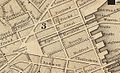
 1844 MarlboroHotel map Boston BPL 10941 detail.png 696 × 707; 956 KB
-
 1844 Plan of the City of Boston, by Samuel N. Dickinson and George W. Boynton.jpg 6,725 × 5,951; 80.9 MB
-
 1844 WinterSt map Boston BPL 10941 detail.png 696 × 707; 967 KB
-
 1850 NathDearborn Boynton map Boston2674451953.jpg 1,794 × 2,000; 3.81 MB
-
 1850 SouthEnd area Boston Boynton Dearborn.png 810 × 713; 1.02 MB
-
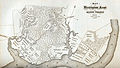 A Map of Washington's Farms at Mt. Vernon (1830 engraving).jpg 4,408 × 2,489; 10.93 MB
-

-
-
 Battle of Brandywine 1777.jpg 2,672 × 4,567; 9.84 MB
-
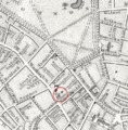
 Bulfinch Triangle detail of 1844 Boynton Plan of the City of Boston.JPG 1,181 × 717; 257 KB
-
 China LOC 2006629360.jpg 4,448 × 3,745; 3.22 MB
-
 China LOC 2006629360.tif 4,448 × 3,745; 47.66 MB
-
 Delaware LOC 2017593558.jpg 4,056 × 4,908; 2.26 MB
-
 Encampment at Valley Forge 1778.jpg 4,350 × 2,676; 7.93 MB
-

-
 Map of the city of Lowell - surveyed in 1841 by order of the municipal authorities LOC 2012592604.tif 10,992 × 9,505; 298.92 MB
-
 Map of the Petersburg Railroad in 1838.jpg 418 × 714; 78 KB
-

-
 Massachusetts map by George W. Boynton, 1844.jpg 3,826 × 2,841; 15.79 MB
-
 Massachusetts map by George W. Boynton, 1846.jpg 4,035 × 2,961; 20.92 MB
-
 Massachusetts map by George W. Boynton, 1851.jpg 3,969 × 2,885; 4.67 MB
-
 Massachusetts map by George W. Boynton, 1852.jpg 4,693 × 3,329; 5.97 MB
-

-

-
-

-

-

-

-

-

-
 Battle of Brandywine, Sept. 11th 1777 (NYPL b15271067-434988).jpg 4,688 × 4,976; 3.14 MB
-
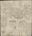
 Plan of Boston with parts of the adjacent towns (2674427051).jpg 2,000 × 1,473; 2.84 MB
-
 Plan of the Battle of Braddock's Defeat at the beginning of action July 9, 1755.jpg 2,658 × 4,531; 9.67 MB
-
 Plan of the city of Boston (2674416495).jpg 2,000 × 1,739; 3.57 MB
-
 Plan of the city of Boston (2675236446).jpg 1,773 × 2,000; 3.07 MB
-
 Tuttle Boynton-United-States-2898x3000.jpg 2,898 × 3,000; 856 KB
-
 United States - Geo. Boynton, sc., Boston. NYPL434846.tiff 4,376 × 5,979; 74.86 MB


.jpg)
.jpg)
.jpg)


.jpg)


.jpg)
.jpg)
.jpg)
.jpg)
.jpg)
.jpg)
.jpg)
.jpg)
.jpg)
.jpg)
.jpg)

.jpg)
.jpg)
