Category:Maps of 11th-century Greece
Jump to navigation
Jump to search
Countries of Europe: Bulgaria · France‡ · Germany · Greece · Italy · Montenegro · Poland · Portugal‡ · Serbia · Spain‡
‡: partly located in Europe
‡: partly located in Europe
| Preceded by: Maps of 10th-century Greece |
Maps of 11th-century Greece 1001 AD-1100 AD |
Succeeded by: Maps of 12th-century Greece |
Media in category "Maps of 11th-century Greece"
The following 4 files are in this category, out of 4 total.
-
 Archbishopric of Ohrid in 1020, map by Dimitar Rizov (1917).jpg 1,557 × 1,608; 868 KB
-
 Bulgaria under Bizantine rule-hu.svg 1,047 × 739; 782 KB
-
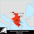 Bulgarian uprising of Peter Delyan (1040-1041)-pt.svg 564 × 558; 163 KB
-
 Shepherd-byzanz 1000-enhanced 1-1900x1500.jpg 1,900 × 1,500; 941 KB
.jpg)

-pt.svg)
