Category:Maps of 12th-century Germany
Jump to navigation
Jump to search
Countries of Europe: Bulgaria · France‡ · Germany · Greece · Italy · Portugal‡ · Serbia · Spain‡
‡: partly located in Europe
‡: partly located in Europe
| Preceded by: Maps of 11th-century Germany |
Maps of 12th-century Germany 1101 AD-1200 AD |
Succeeded by: Maps of 13th-century Germany |
Media in category "Maps of 12th-century Germany"
The following 8 files are in this category, out of 8 total.
-

-
 Bourbonnais 12. Jh.png 557 × 494; 141 KB
-
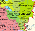
 Burgund 12. Jh.png 1,792 × 1,471; 1,006 KB
-
 Frankreich 12. Jh (ohne Süd).png 2,607 × 2,640; 2.41 MB
-
 Frankreich 12. Jh 2021-08-03.png 2,607 × 2,640; 2.47 MB
-
 Krondomäne 12. Jh.png 1,054 × 1,017; 481 KB
-
 367 of 'Schlesien. Eine Landeskunde für das deutsche Volk, etc' (11237040824).jpg 2,368 × 1,554; 677 KB
-
 Atlas of European history (1909) (14803830803).jpg 2,166 × 3,608; 1.64 MB
.jpg)


.png)


.jpg)
_(14803830803).jpg)