Category:Maps of 5th-century Asia
Jump to navigation
Jump to search
Subcategories
This category has the following 3 subcategories, out of 3 total.
Media in category "Maps of 5th-century Asia"
The following 12 files are in this category, out of 12 total.
-
 1865 Spruner Map of the Holy Land - 4th-5th century Levant crop.jpg 610 × 906; 156 KB
-
 MACCOUN(1899) p203 ABOUT 400 A.D. - PALESTINE AT THE BEGINNING OF THE FIFTH CENTURY.jpg 2,014 × 3,606; 2.91 MB
-
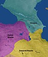 Khazars498.jpg 402 × 480; 115 KB
-
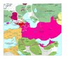
 Liu Song Division.png 1,802 × 1,275; 91 KB
-
 Map of the Rouran Khaganate.png 1,886 × 1,038; 4.49 MB
-
 Moyen-Orient en 400.pdf 1,752 × 1,239; 477 KB
-
 Moyen-Orient en 450.pdf 1,752 × 1,239; 430 KB
-
 Nirun, Tuyuhun, Yueban, Tuoba Wei.jpg 943 × 519; 230 KB
-
 Northern Liang and Gaochang.png 1,229 × 859; 371 KB
-
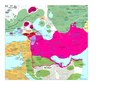
 Northern Wei 464.png 1,209 × 853; 295 KB
-
 北魏・斉.PNG 757 × 606; 32 KB
-
 西魏・東魏・梁.PNG 757 × 606; 36 KB

_p203_ABOUT_400_A.D._-_PALESTINE_AT_THE_BEGINNING_OF_THE_FIFTH_CENTURY.jpg)


