Category:Maps of Adjara
Jump to navigation
Jump to search
Wikimedia category | |||||
| Upload media | |||||
| Instance of | |||||
|---|---|---|---|---|---|
| Category combines topics | |||||
| Adjara | |||||
political-administrative region of Georgia     | |||||
| Instance of | |||||
| Location | Georgia | ||||
| Capital | |||||
| Official language | |||||
| Currency | |||||
| Head of government | |||||
| Inception |
| ||||
| Highest point |
| ||||
| Population |
| ||||
| Area |
| ||||
| Different from | |||||
| official website | |||||
 | |||||
Subcategories
This category has the following 3 subcategories, out of 3 total.
Pages in category "Maps of Adjara"
This category contains only the following page.
Media in category "Maps of Adjara"
The following 35 files are in this category, out of 35 total.
-
 1940 German military map - Batum und Umgebung - Sheet 1.jpg 15,105 × 12,986; 39.56 MB
-
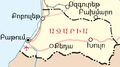
 Adjar ASSR Map hy.png 634 × 354; 38 KB
-
 Adjara map.png 634 × 354; 45 KB
-
 Adjara-Ka.svg 600 × 400; 564 KB
-
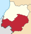
 Adjara-khelvachauri-ka.svg 600 × 400; 567 KB
-
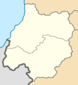
 Adjara-khulo-ka.svg 600 × 400; 568 KB
-
 Adjara-kobuleti-ka.svg 600 × 400; 567 KB
-
 Adjara-shuakhevi-ka.svg 600 × 400; 568 KB
-
 Adjara.svg 2,400 × 1,470; 48 KB
-
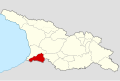
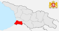 AdjaraLocationinGeorgia.svg 774 × 413; 716 KB
-
 Admiralty Chart No 3303 Batum Bay, Published 1911.jpg 11,047 × 8,146; 23.9 MB
-
 Adzarië.PNG 560 × 300; 15 KB
-
 Agiaria map.png 634 × 354; 43 KB
-
 Ajara map he.png 634 × 354; 34 KB
-
 Ajara map hy.png 634 × 354; 25 KB
-
 Ajara map.png 634 × 354; 18 KB
-
 Ajara map–ka.png 634 × 354; 16 KB
-
 Ajaria02.png 847 × 555; 30 KB
-
 Artvin Okrug of Batum Oblast.png 651 × 712; 12 KB
-
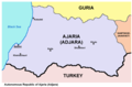
 Autonomous Republic of Adjara in Georgia.svg 1,715 × 913; 229 KB
-
 Batum Oblast ATD.png 651 × 712; 12 KB
-
 Batum Okrug of Batum Oblast.png 651 × 712; 12 KB
-
 Gegeichnet von I.C.M. Reinecke. Guriel. 1804.jpg 1,682 × 874; 256 KB
-
 Georgia - Municipality of Kobuleti.svg 1,251 × 886; 42 KB
-
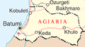
 Georgia Ajaria map.png 560 × 300; 14 KB
-
 Georgia template.png 672 × 360; 65 KB
-

-
 Historical Adjara in modern international borders of Georgia.svg 942 × 633; 345 KB
-
 ICG Map of Western Georgia.JPG 776 × 635; 68 KB
-
 Khelvachauri.png 1,476 × 768; 208 KB
-
 Khulo.png 1,476 × 768; 209 KB
-
 Kobuleti.png 1,476 × 768; 209 KB
-
 Map of the Battle of Tsikhisdziri 1878.png 3,256 × 2,974; 5.33 MB
-
 Shuakhevi.png 1,476 × 768; 209 KB
-
 Аджария на административной карте Грузии.png 800 × 448; 89 KB


