Category:Maps of Amerongen
Jump to navigation
Jump to search
Nederlands: Kaarten (plattegronden) van Amerongen
Media in category "Maps of Amerongen"
The following 12 files are in this category, out of 12 total.
-

-
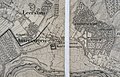 Exterieur TOPOGRAFISCHE KAART (1850) - Amerongen - 20261370 - RCE.jpg 1,200 × 775; 359 KB
-
 Exterieur TOPOGRAFISCHE KAART (487, 1922) - Amerongen - 20261367 - RCE.jpg 1,200 × 792; 295 KB
-

-
 Locatie Amerongen 2005.png 280 × 130; 9 KB
-

-

-
-

-
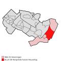
 Map - NL - Utrechtse Heuvelrug - Wijk 03 Amerongen.svg 625 × 575; 12 KB
-
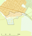 Rijksbeschermd stads- of dorpsgezicht - Amerongen.png 2,016 × 2,267; 167 KB
-


_-_Amerongen_-_20261370_-_RCE.jpg)
_-_Amerongen_-_20261367_-_RCE.jpg)


