Category:Maps of Bésingrand
Jump to navigation
Jump to search
Wikimedia category | |||||
| Upload media | |||||
| Instance of | |||||
|---|---|---|---|---|---|
| Category combines topics | |||||
| Bésingrand | |||||
commune in Pyrénées-Atlantiques, France   | |||||
| Instance of | |||||
| Location |
| ||||
| Located in or next to body of water | |||||
| Population |
| ||||
| Area |
| ||||
| official website | |||||
 | |||||
Media in category "Maps of Bésingrand"
The following 9 files are in this category, out of 9 total.
-
 64117-Bésingrand-argile.jpg 3,057 × 2,480; 356 KB
-
 64117-Bésingrand-Routes-Hydro.png 3,507 × 2,480; 1.49 MB
-
 64117-Bésingrand-Sols.png 3,270 × 2,598; 1.2 MB
-
 64117-Bésingrand-ZNIEFF1.png 3,057 × 2,480; 2.03 MB
-
 64117-Bésingrand-ZNIEFF2.png 5,866 × 4,133; 4.3 MB
-
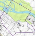
 Bésingrand OSM 01.png 609 × 534; 286 KB
-
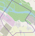
 Bésingrand OSM 02.png 580 × 583; 250 KB
-
 Bésingrand OSM 03.png 580 × 583; 168 KB
-
 Map commune FR insee code 64117.png 756 × 605; 29 KB


