Category:Maps of Bedfordshire
Jump to navigation
Jump to search
Wikimedia category | |||||
| Upload media | |||||
| Instance of | |||||
|---|---|---|---|---|---|
| Category combines topics | |||||
| Bedfordshire | |||||
ceremonial county of England    | |||||
| Instance of |
| ||||
| Location |
| ||||
| Capital | |||||
| Population |
| ||||
| Area |
| ||||
| Different from | |||||
| Said to be the same as | Bedfordshire (historic county of England, ceremonial county of England, 1844) | ||||
| official website | |||||
 | |||||
Subcategories
This category has the following 9 subcategories, out of 9 total.
- Old county maps of Bedfordshire (13 F)
E
- Election maps of Bedfordshire (36 F)
H
- Hundreds of Bedfordshire (11 F)
M
O
R
Media in category "Maps of Bedfordshire"
The following 46 files are in this category, out of 46 total.
-
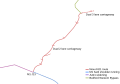
 2 Lee Valley Walk.png 878 × 705; 22 KB
-
 2009 Bedfordshire Ceremonial Numbered.png 200 × 298; 3 KB
-
 A421 developments.svg 913 × 639; 8 KB
-
 Ampthill - Bedfordshire dot.png 417 × 599; 122 KB
-
 Archaeological map of Caddington and Dunstable district. Wellcome M0015598.jpg 3,750 × 2,929; 4.58 MB
-
 Bedford - Bedfordshire dot.png 1,802 × 2,589; 189 KB
-
 Bedfordshire - British Isles.svg 1,260 × 1,835; 943 KB
-
 Bedfordshire Brit Isles Sect 5.svg 809 × 743; 939 KB
-
 Bedfordshire Ceremonial Numbered.png 200 × 298; 5 KB
-
 Bedfordshire Hundreds 1830.png 1,648 × 2,336; 203 KB
-
 Bedfordshire map.png 730 × 1,111; 23 KB
-
 Bedfordshire numbered districts.svg 1,120 × 1,266; 499 KB
-
 Bedfordshire outline map with UK (2009).png 504 × 600; 190 KB
-
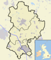 Bedfordshire outline map with UK.png 504 × 600; 196 KB
-
 Bedfordshire UK constituency map (blank).svg 1,120 × 1,266; 723 KB
-
 Bedfordshire UK district map (blank).svg 1,120 × 1,266; 675 KB
-
 Bedfordshire UK location map.svg 1,120 × 1,266; 1.34 MB
-
 Bedfordshire UK locator map 2010.svg 1,108 × 1,345; 302 KB
-
 Bedfordshire UK parish map (blank).svg 1,120 × 1,266; 1.33 MB
-
 Bedfordshire UK relief location map.jpg 2,006 × 2,269; 381 KB
-
 Bedfordshire UK ward map (blank).svg 1,120 × 1,266; 1.13 MB
-
 Bedfordshire-fire-stations-map.svg 572 × 819; 23 KB
-
 Bedfordshire1832Map.png 1,309 × 1,595; 273 KB
-
 BedfordshireBrit5.PNG 625 × 569; 26 KB
-
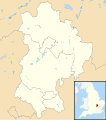
 BedfordshireCeremonialCounty.png 530 × 599; 6 KB
-
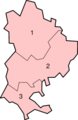 BedfordshireNumbered.png 200 × 307; 19 KB
-
 Carlton Bedfordshire map.png 408 × 345; 23 KB
-

-
 England Police Forces (Bedfordshire).svg 1,108 × 1,345; 312 KB
-
 EnglandBedfordshire.png 200 × 247; 22 KB
-
 EnglandBedfordshireTrad.png 200 × 250; 28 KB
-
 EnglandPoliceBedfordshire.png 2,165 × 2,670; 87 KB
-
 EnglandSouthMidlands.png 200 × 247; 26 KB
-
 Houghton Regis - Parish Map.jpg 1,109 × 876; 376 KB
-
 Hundred of Willey Map.jpg 1,000 × 1,301; 300 KB
-
 Bedfordshire Hundreds.svg 1,000 × 1,580; 231 KB
-
 Jefferys' 1765 map of Beds Dunstable.jpg 1,047 × 661; 232 KB
-
 Luton UK ward map 2010 (blank).svg 1,345 × 1,266; 174 KB
-
 LutonDunstableBUA.png 1,618 × 850; 92 KB
-
 Map of Grey (of Ruthin) locations in Bedfordshire.svg 627 × 874; 1.74 MB
-
 Odell-location-in-Bedfordshire.svg 572 × 819; 27 KB
-
 Ordnance Survey 1-250000 - SP.jpg 4,000 × 4,000; 9.22 MB
-
 Ordnance Survey 1-250000 - TL.jpg 4,000 × 4,000; 8.45 MB
-
 Sandy bedfordshire map.png 711 × 758; 91 KB
-
 Uk-beds.png 145 × 173; 6 KB
-
 Woburn - Bedfordshire dot.png 417 × 599; 122 KB


.png)


.png)
.svg)


_locations_in_Bedfordshire.svg)


.svg)
.svg)
.svg)
.svg)
.svg)