Category:Maps of Berlin-Kreuzberg
Jump to navigation
Jump to search
Wikimedia category | |||||
| Upload media | |||||
| Instance of | |||||
|---|---|---|---|---|---|
| Category combines topics | |||||
| Kreuzberg | |||||
locality of Berlin, Germany  _Flag.svg) _COA.svg)   | |||||
| Pronunciation audio | |||||
| Instance of | |||||
| Named after | |||||
| Location |
| ||||
| Head of government |
| ||||
| Population |
| ||||
| Area |
| ||||
| Elevation above sea level |
| ||||
| Different from | |||||
 | |||||
Media in category "Maps of Berlin-Kreuzberg"
The following 29 files are in this category, out of 29 total.
-
 1840 Grundriß von Berlin Gasbeleuchtungsanstalt.jpg 1,020 × 678; 705 KB
-

-
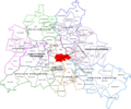
 Berlin Friedrichshain-Kreuzberg Kreuzberg.png 410 × 281; 26 KB
-
 Berlin Markthalle XI Lageplan.jpg 2,251 × 1,566; 738 KB
-
 Berlin Militaerarrest-1896.jpg 666 × 739; 127 KB
-
 Berlin-kottbusser-tor-karte-Mario Duhanic.png 1,700 × 1,500; 174 KB
-
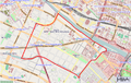
 Berlin-Kreuzberg Karte.png 1,067 × 638; 641 KB
-
 Böcklerpark berlin.png 1,756 × 1,242; 138 KB
-
 Map de-be friedrichstadt.png 985 × 1,075; 353 KB
-
 Berlin Markthalle II Lageplan.jpg 1,729 × 1,231; 693 KB
-
 BerlinAskanischesGymnasium.png 516 × 460; 384 KB
-
 Görlitzerpark berlin.png 1,756 × 1,242; 328 KB
-
 Karte Lohmühleninsel Berlin.JPG 929 × 602; 169 KB
-
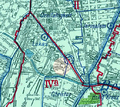
 KarteSO36.png 754 × 476; 197 KB
-
 Kreuzberg.png 1,264 × 1,056; 540 KB
-
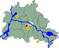
 Lage Kreuzberg in Berlin.png 484 × 395; 30 KB
-
 Lage Kreuzberg SO 36 in Berlin.png 484 × 395; 30 KB
-
 Lage Kreuzberg SW 61 in Berlin.png 484 × 395; 30 KB
-
 Lage Kreuzberg.png 1,833 × 1,514; 163 KB
-
 Berlin Markthalle IX Lageplan.jpg 2,656 × 1,685; 1.02 MB
-
 Berlin Markthalle VII Lageplan.jpg 1,948 × 1,672; 650 KB
-
 Luisenstaedtischer kanal.svg 1,201 × 2,100; 736 KB
-
-
 Oberland Tempelhof 1842.JPG 725 × 455; 163 KB
-
 Oranienplatz, Berlin.svg 2,890 × 1,739; 2.9 MB
-
 Otto-Suhr-Siedlung 2017.png 970 × 759; 986 KB
-
 Richter 1915 Ausschnitt Berlin-Kreuzberg.jpg 2,077 × 2,570; 7.97 MB
-
 St Michael Berlin Pharus Plan.JPG 500 × 500; 99 KB
-
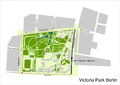 Victoria park berlin.png 1,758 × 1,244; 232 KB

_(14580331427).jpg)


