<nowiki>Category:Maps of Bundesautobahn 6; categoría de Wikimedia; kategori Wikimedia; Wikimedia category; د ويکيمېډيا وېشنيزه; Vikimedya kategorisi; ویکیمیڈیا زمرہ; kategória projektov Wikimedia; категорія проєкту Вікімедіа; 维基媒体分类; Wikimedia-Kategorie; kategorie na projektech Wikimedia; kategorija na Wikimediji; विकिपीडिया:श्रेणी; page de catégorie de Wikimedia; kategorija na Wikimediji; विकिपीडिया वर्ग; категорија на Викимедији; Wikimedia-Kategorie; Wikimedia-kategori; kategori Wikimédia; تصنيف ويكيميديا; pajenn rummata eus Wikimedia; Wikimedia:ကဏ္ဍခွဲခြင်း; 維基媒體分類; Wikimedia категориясы; categoría de Wikimedia; categoria de Wikimedia; Wikimedia-Kategorie; tudalen categori Wikimedia; Viciméid catagóir; ردهٔ ویکیپدیا; 维基媒体分类; Wikimedia-kategori; ვიკიპედია:კატეგორიზაცია; ウィキメディアのカテゴリ; categoria Wikimedia; تصنيف بتاع ويكيميديا; විකිමීඩියා ප්රභේද පිටුව; categoria Vicimediorum; Vikipidiya:Shopni; Wikimedia-luokka; Wikimedia category; guruhi Vikimedia; катэгорыя ў праекце Вікімэдыя; Викимедиа проектындагы төркем; catigurìa di nu pruggettu Wikimedia; หน้าหมวดหมู่วิกิมีเดีย; Wikimedia:Kategorija; Wikimedia-Kategorie; Wikimedia:Klassys; категория на Уикимедия; categorie a unui proiect Wikimedia; categurìa 'e nu pruggette Wikimedia; Wikimedia-kategori; kawan Wikimèdia; 維基媒體分類; 위키미디어 분류; Wikimedia-bólkur; kategorio en Vikimedio; kategori Wikimedia; Wikimedia:Ronnaghys; উইকিমিডিয়া বিষয়শ্রেণী; kategori Wikimedia; 维基媒体分类; וויקימעדיע קאַטעגאָריע; kategorija w projektach Wikimedije; thể loại Wikimedia; Wikimedia projekta kategorija; kategoria ti Wikimedia; categoria de um projeto da Wikimedia; 维基媒体分类; категорияд Ангилал; Wikimedia-kategori; kategori Wikimedia; پۆلی ویکیمیدیا; Wikimedia category; Vikimédia ñemohenda; Wikimédia-kategória; વિકિપીડિયા શ્રેણી; Wikimediako kategoria; категория в проекте Викимедиа; Wikimedia-Kategorie; катэгорыя ў праекце Вікімедыя; Wikimedia-kategorie; Wîkîmediya:Kategorî; विकिमिडिया श्रेणी; Wikimedia-Kategorie; קטגוריה במיזמי ויקימדיה; Викимедиа проектындагы төркем; 維基媒體分類; विकिमिडिया श्रेणी; 维基媒体分类; Wikimedia-kategoriija; гурӯҳи Викимедиа; kategoria w projekcie Wikimedia; categoría de Wikimedia; 維基媒體分類; categoria di un progetto Wikimedia; Wikimedia-categorie; Wikimedia category; 維基媒體分類; Wikimedia kategooria; Wikimedia-Kategorie; Wikimedia-kategory; kategorya ng Wikimedia; гурӯҳи Викимедиа; ẹ̀ka Wikimedia; Викимедиина категорија; categoria de um projeto da Wikimedia; Wikimedia-Kategorie; Վիքիմեդիայի նախագծի կատեգորիա; tumbung Wikimedia; Wikimedia-kategorie; kategorija Wikimedie; Wikimedia proyektındağı törkem; Kategoriya ning Wikimedia; Wikimedia-categorie; kategori Wikimedia; jamii ya Wikimedia; വിക്കിമീഡിയ വർഗ്ഗം; Wikimedia-categorie; kategori Wikimedia; விக்கிமீடியப் பகுப்பு; زمرو:وڪيپيڊيا زمرا بندي; Викимедиа категорияһы; categoría de Wikimedia; kategori e Wikimedias; κατηγορία εγχειρημάτων Wikimedia; विकिमीडिया श्रेणी</nowiki>


 Bundesautobahn 6 map.png 1,122 × 1,515; 63 KB
 Map D A6.svg 1,073 × 1,272; 467 KB
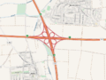 AK Frankenthal map.png 818 × 613; 548 KB
 AD Kaiserslautern map.png 817 × 614; 655 KB
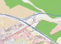 Autobahndreieck Kaiserslautern der A6 und A63.png 1,520 × 1,102; 631 KB
 AK Mannheim map.png 817 × 613; 752 KB
 Autobahnkreuz Mannheim der A6 und A656.png 1,521 × 1,102; 529 KB
 Karte Verkehrswege Großraum Mannheim.png 3,250 × 3,347; 8.14 MB
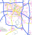 Mannheim-Strassenverkehr.png 560 × 616; 160 KB
 Strassennetz nuernberg.png 1,870 × 1,408; 515 KB
 Kreuz Nürnberg-Süd.svg 1,179 × 1,071; 343 KB
 AK Oberpfälzer Wald map.png 818 × 613; 482 KB
 Autobahndreieck Saarbrücken der A6 und der A620.png 1,520 × 1,102; 883 KB
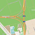 Dreieck Viernheim.jpg 481 × 482; 106 KB
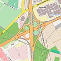 Viernheimer Kreuz.jpg 355 × 356; 102 KB
 AK Walldorf map.png 819 × 614; 437 KB
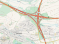 AK Weinsberg map.png 817 × 613; 892 KB
 Autobahnkreuz Weinsberg Plan.png 1,994 × 1,474; 155 KB


