Category:Maps of Canada
Hopp til navigering
Hopp til søk
Land i Nord-Amerika: Antigua og Barbuda · Bahamas · Barbados · Belize · Canada · Costa Rica · Cuba · Dominica · Den dominikanske republikk · El Salvador · Grenada · Guatemala · Haiti · Honduras · Jamaica · Mexico · Nicaragua · Panama · Saint Kitts og Nevis · Saint Lucia · Saint Vincent og Grenadinene · Trinidad og Tobago‡ · USA‡
Andre territorier: De amerikanske Jomfruøyer · Anguilla · Bermuda · De britiske Jomfruøyer · Caymanøyene · Florida Keys · Grønland · Guadeloupe · Martinique · Montserrat · Puerto Rico · Saint-Barthélemy · Saint-Martin · Saint-Pierre og Miquelon · Turks- og Caicosøyene
‡: delvis plassert i Nord-Amerika
English: Maps of Canada.
Español: Mapas de Canada.
Use the appropriate category for maps showing all or a large part of Canada. See subcategories for smaller areas:
| If the map shows | Category to use |
|---|---|
| Canada on a recently created map | Category:Maps of Canada or its subcategories |
| Canada on a map created more than 70 years ago | Category:Old maps of Canada or its subcategories |
| the history of Canada on a recently created map | Category:Maps of the history of Canada or its subcategories |
| the history of Canada on a map created more than 70 years ago | Category:Old maps of the history of Canada or its subcategories |
Wikimedia-kategori | |||||
| Last opp mediefiler | |||||
| Forekomst av | |||||
|---|---|---|---|---|---|
| Kategorien kombinerer emnene | |||||
 | |||||

Underkategorier
Denne kategorien har følgende 14 underkategorier, av totalt 14.
Sider i kategorien «Maps of Canada»
Denne kategorien inneholder kun følgende side.
Filer i kategorien «Maps of Canada»
Følgende 192 filer er i denne kategorien, av totalt 192.
-
 'ndrangheta In Canada 2017.jpg 1 050 × 626; 113 KB
-
 1 CRPG Patrols.jpg 768 × 610; 479 KB
-
 134721main3 seaice min 1979 250.jpg 250 × 188; 51 KB
-

-

-
 1885 Map of Renfrew County, Ontario.jpg 800 × 1 123; 166 KB
-
 20160728 ECHO Canada Ontario Province.png 1 123 × 794; 775 KB
-
 20160728 ECHO ThunderBayRegion.pdf 1 754 × 1 239; 550 KB
-
 20160728 ECHO ThunderBayRegion.png 1 123 × 794; 866 KB
-

-
 6 of 'American Indians' (11249335476).jpg 1 888 × 1 305; 514 KB
-

-
 706x599-Canada-(geolocalisation)-R1.jpg 706 × 599; 98 KB
-
 Alberta Köppen.png 5 400 × 10 800; 399 KB
-
 Alerte warning Canada fr.PNG 896 × 607; 88 KB
-
 Alfred Ernest Ice Shelf map 01.jpg 1 786 × 1 669; 1,08 MB
-
 Algonquiens.png 690 × 393; 146 KB
-

-
 Anishinaabemowin map.jpg 594 × 377; 146 KB
-
 ASPC area of responsibility 2012.jpg 2 517 × 1 741; 373 KB
-
 Atlantic Canada - Natural Earth.jpg 1 008 × 713; 352 KB
-
-
 Bacchus Motorcycle Club Map.png 1 278 × 667; 161 KB
-
 Banks topo.png 2 000 × 2 114; 3,58 MB
-
 Bas-Canada.jpg 472 × 428; 23 KB
-
 Battle of Sorel.png 816 × 856; 524 KB
-
 Bistum Kamloops.svg 512 × 368; 292 KB
-
 Bistum Nelson.svg 512 × 368; 292 KB
-
 Bistum Prinz George.svg 512 × 368; 292 KB
-
 Bistum Victoria.svg 512 × 368; 292 KB
-
 BlankMap-Canada-South.png 707 × 432; 16 KB
-
 Borden-System.jpg 1 102 × 576; 214 KB
-
 Canada 'ndrangheta.gif 1 148 × 968; 84 KB
-
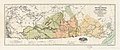
 Canada (Maps 6,7,8,9,10,11,16,17) - DPLA - c8c22580a8b6b4a06f327c8116c49cb9.jpg 10 800 × 15 722; 18,9 MB
-

-

-

-

-
 Canada by percent of Forest Cover.png 4 115 × 3 475; 1,17 MB
-
 Canada disputed w1 countrymap.svg 1 000 × 1 000; 152 KB
-
 Canada ethnic origin map 2021.png 2 230 × 1 735; 2,37 MB
-
 Canada Exclusive Economic Zone.PNG 2 410 × 1 178; 155 KB
-
 Canada Four Corners map.png 262 × 212; 4 KB
-
 Canada geo hsi.png 1 002 × 462; 78 KB
-
 Canada geopolitical map trim.jpg 1 182 × 1 107; 200 KB
-
 Canada Little Leagues.svg 1 084 × 920; 97 KB
-
 Canada Map - Active Sites Logo Legend 2009-04-21.TIF 731 × 683; 69 KB
-
 Canada map.PNG 280 × 230; 13 KB
-
 Canada North South Regions StatCan.png 2 700 × 2 250; 132 KB
-
 Canada provinces english.png 1 000 × 864; 41 KB
-
 Canada provinces evolution 2.gif 1 000 × 864; 243 KB
-
 Canada provinces evolution de.gif 1 000 × 864; 249 KB
-
 Canada provinces evolution-250.gif 250 × 216; 211 KB
-
 Canada provinces evolution.gif 1 000 × 864; 247 KB
-
 Canada provinces key.png 118 × 87; 2 KB
-
 Canada regions map (uk).png 1 579 × 1 509; 473 KB
-
 Canada regions map (zh-hans).png 1 597 × 1 527; 555 KB
-
 Canada tree line map.png 706 × 599; 123 KB
-
 Canada TV Markets map.svg 512 × 434; 1,19 MB
-
 Canada-1870-fr.gif 465 × 385; 12 KB
-
 Canada-map-greek.png 2 007 × 1 353; 172 KB
-
 Canada-provinces layout.png 852 × 698; 140 KB
-
 Canada-usa.en.png 764 × 449; 148 KB
-
 Canada-usa.png 774 × 422; 129 KB
-
 CanadaDeptMines AB-SK-MB MapReproduction1914 (Detail).jpg 366 × 357; 156 KB
-
 CanadaIsSouthOfTheUnitedStates.svg 830 × 600; 97 KB
-
 Canadamaplanguages.png 1 084 × 920; 172 KB
-
 Canadawineregions.png 1 388 × 1 214; 67 KB
-
 Canadian Coast Guard Regions.png 1 471 × 1 208; 374 KB
-
 Canadian Geospace Monitoring.png 500 × 406; 61 KB
-
 Canadian Made by Primitive Entertainment.jpg 800 × 450; 242 KB
-
 Canadian Northern Corridor map.png 619 × 336; 57 KB
-
 CanadiansForAnnexation2001.png 1 347 × 740; 124 KB
-
 CANARIE Network Map (August, 2016).png 10 135 × 8 299; 2,68 MB
-
 CANARIEMap.png 5 025 × 4 081; 1,17 MB
-
 Canfourcornermap.png 280 × 230; 14 KB
-
 Canregions.PNG 638 × 593; 65 KB
-
 Cantvmarkets.png 1 380 × 1 204; 129 KB
-
 CAplatemounting.svg 1 114 × 942; 205 KB
-
 Carte canada2 regions.jpg 903 × 635; 114 KB
-
 Carte Montreal-Mascouche.png 581 × 599; 41 KB
-
 CDNnortherncorridor.jpg 619 × 336; 53 KB
-
 Censusdivisions.PNG 1 388 × 1 214; 105 KB
-
 CHA-map-CapacityPotential-2015-940px.jpg 940 × 705; 163 KB
-
 Champlain Sea 1.png 852 × 735; 566 KB
-
 Champlain Sea-ka.png 852 × 735; 728 KB
-
 Champlain Sea.png 852 × 735; 543 KB
-
 CIS football locations.png 850 × 265; 75 KB
-
 Comparison Size with Canada map.GIF 519 × 1 369; 24 KB
-
 County Wars Canada Alternia.PNG 1 388 × 1 214; 111 KB
-
 Cut Victoria island.jpg 254 × 381; 158 KB
-
 Devon topo.png 2 196 × 1 794; 3,01 MB
-
 Disputed Border in the East.jpg 3 813 × 3 072; 3,21 MB
-
 Duvernay depositional extent in central Alberta, Canada.tif 1 403 × 965; 5,17 MB
-

-
 Ellesmere topo.png 2 000 × 1 723; 3,35 MB
-
 Ethnic copy.jpg 1 388 × 1 214; 140 KB
-
 Exhibit at the local museum in Appleton ON (37343370846).jpg 4 032 × 3 024; 3,17 MB
-
 FEB 11 2021 Updated CCG Regional Map.jpg 3 300 × 2 550; 568 KB
-
 Flemish Cap.gif 281 × 272; 17 KB
-
 FLII Canada.png 1 287 × 744; 666 KB
-
 Fr canada2.jpg 952 × 793; 504 KB
-
 Fragment d'une carte manuscrite de Champlain 1607.jpg 4 895 × 3 219; 2,05 MB
-
 Franklin's-Lost-Expedition.png 1 024 × 768; 81 KB
-
 Geo location canada.png 420 × 283; 72 KB
-

-
 Gods pocket.gif 567 × 397; 16 KB
-
 Golfe Saint-Laurent fr.png 600 × 555; 102 KB
-
 Grand Banks FR.png 799 × 683; 108 KB
-
 Grand Banks.png 700 × 683; 227 KB
-
 Great divide trail map.jpg 452 × 544; 103 KB
-
 Gulf of Saint Lawrence 2.jpg 734 × 456; 99 KB
-
 GulfofMaine2.jpg 523 × 544; 160 KB
-
 Hastings County Archives OSD 1938-1939-80 (40191567114).jpg 3 368 × 2 096; 860 KB
-
 Haut et Bas-Canada.png 321 × 208; 22 KB
-
 Haut et Bas-Canada2.png 1 252 × 832; 655 KB
-
 Hudson Bay Exploration Western Interior map de.png 1 020 × 815; 915 KB
-

-
 Hunters of the great north (1922) (14587162399).jpg 3 044 × 2 368; 879 KB
-
 IFMA chapters coverage map.png 4 700 × 4 515; 1,92 MB
-
 Income Per Capita Map 1986 Census.jpg 5 350 × 4 700; 9,66 MB
-
 Intermontane-Plateaus (North).png 683 × 558; 720 KB
-
 Inuvialuit Settlement Region.png 1 997 × 1 251; 153 KB
-
 Jianada ditu-zh.png 1 280 × 1 128; 324 KB
-
 Kanada Map.jpg 674 × 508; 74 KB
-
 Kap-Breton-Insel.png 1 180 × 825; 288 KB
-
 KeewatinNIEdot400.jpg 960 × 752; 157 KB
-
 Koukdjuak.JPG 548 × 293; 44 KB
-
 Labrador sea map with state labels.png 500 × 426; 189 KB
-
 Legenda províncias Canadá.png 118 × 87; 3 KB
-
 Les Acadiens.png 1 180 × 824; 443 KB
-
 Location Ungava Peninsula.png 250 × 115; 3 KB
-
 MABR map.jpg 990 × 743; 266 KB
-
 Map of Canada (Korean Ver.).png 3 304 × 2 748; 2,06 MB
-
 Map of Canada.png 823 × 695; 166 KB
-
 Map of Gulf of Saint Lawrence-No names.png 1 059 × 944; 307 KB
-
 Map of Gulf of Saint Lawrence02.png 406 × 271; 43 KB
-
 Map of part of the North West Territory including the Province of Manitoba.jpg 11 618 × 4 842; 12,38 MB
-
 Map2-NC-2019WIKIPEDIA.jpg 3 593 × 3 321; 2,39 MB
-
 Map2-NC-edit.jpg 3 593 × 3 321; 2,3 MB
-
 Mapa do Canadá (OCHA).svg 254 × 254; 2,62 MB
-
 Mapchart.JPG 677 × 673; 115 KB
-
 Marathon of Hope path.png 564 × 422; 569 KB
-
 Maritime Fur Trade-NorthWestCoast ru.png 1 199 × 848; 253 KB
-
 MRAMGE.jpg 1 500 × 1 053; 324 KB
-
 Northern Corridor Map.png 2 200 × 1 701; 132 KB
-
 NORTHWEST ANGLE.png 488 × 403; 251 KB
-
 NTS Zones and Map Series Numbers.png 1 476 × 1 108; 691 KB
-

-
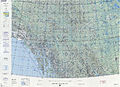
 Operational Navigation Chart C-9, 6th edition.jpg 9 053 × 6 596; 18,9 MB
-
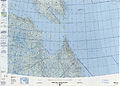
 Operational Navigation Chart D-11, 5th edition.jpg 9 254 × 6 660; 20,53 MB
-
 Operational Navigation Chart D-12, 6th edition.jpg 9 254 × 6 698; 23 MB
-
 Operational Navigation Chart D-13, 4th edition.jpg 9 254 × 6 662; 16,54 MB
-
 Operational Navigation Chart D-14, 5th edition.jpg 9 254 × 6 680; 17,19 MB
-
 Operational Navigation Chart D-15, 4th edition.jpg 9 254 × 6 666; 16,56 MB
-
 Operational Navigation Chart E-15, 7th edition.jpg 9 254 × 6 789; 21,01 MB
-
 Operational Navigation Chart E-16, 11th edition.jpg 9 254 × 6 773; 17,9 MB
-
 Operational Navigation Chart E-17, 11th edition.jpg 9 254 × 6 777; 20,79 MB
-
 Operational Navigation Chart E-19, 6th edition.jpg 9 254 × 6 721; 15,94 MB
-
 PacNWComparison.PNG 230 × 262; 9 KB
-
 Canadian National Parks Location.png 976 × 790; 112 KB
-

-
 Plan du Fort du Sault-Saint-Louis, 1752.jpg 469 × 541; 68 KB
-
 Population density of Canada provinces and territories.png 5 601 × 3 435; 1,17 MB
-
 Professional soccer clubs of Canada, 2011.PNG 770 × 575; 96 KB
-
 Provincies y territorios de Canadá.png 746 × 611; 288 KB
-
 Provmap-base.png 250 × 210; 24 KB
-
 Quebec City-Windsor Corridor.gif 640 × 600; 39 KB
-
 Queen Elizabeth islands map.gif 700 × 675; 44 KB
-
 Railroads-Canada-frame.png 860 × 691; 174 KB
-
 Rannikkovuoret sijainti.png 271 × 249; 28 KB
-
 Rivers-Canada-frame.png 860 × 691; 164 KB
-
 Régions de la Garde Côtière Canadienne.png 1 488 × 1 219; 384 KB
-
 Samuel Hearne 1770–1772 expeditions map.png 1 663 × 1 375; 155 KB
-
 Secwepemcúl'ecw in Canada.png 2 356 × 2 000; 2,37 MB
-
 Service map.jpg 610 × 500; 31 KB
-
 Site du patrimoine de La Poudrière - outils en bois.jpg 4 608 × 3 072; 7,24 MB
-
 Six Nations of the Grand River Electoral Districts.svg 651 × 562; 11 KB
-
 StLawrence Gulf bathymetry.jpg 820 × 505; 90 KB
-
 Supposed Route of Franklin's expedition 1845-1848 DE.svg 999 × 700; 1,73 MB
-

-
-
 TorontoAmalgamation1834to1998Animated.gif 2 205 × 1 671; 1,31 MB
-
 U Sports Men's Volleyball Locations.png 850 × 265; 74 KB
-
 U Sports Women's Volleyball Locations.png 850 × 265; 76 KB
-
 Ungava Bay map.png 700 × 595; 222 KB
-
 Victoria topo.png 2 000 × 1 735; 3,26 MB
-
 Waban-Aki.png 727 × 466; 88 KB
-
 Weeklycumulativecases.gif 1 500 × 1 000; 1,33 MB
-
 Western Canada map.gif 132 × 89; 1 KB
-
 Wind power canada.PNG 277 × 222; 7 KB
-
 Yn Chanadey.png 2 000 × 1 728; 168 KB


.jpg)
.jpg)


%27_(11246254313).jpg)
.jpg)
_use_fileTeller_and_Leverington,_2004.jpg)
-R1.jpg)


_(21116780506).jpg)


_(20344760155).jpg)


_-_DPLA_-_c8c22580a8b6b4a06f327c8116c49cb9.jpg)
_(1886)_(20426149880).jpg)
_(1886)_(20427417149).jpg)
_(14780376041).jpg)
_(14784577332).jpg)


.png)
.png)


.jpg)


.png)


.jpg)


.jpg)


_(14592378998).jpg)
_(14587162399).jpg)


.png)


.png)


.svg)


_(14763699335).jpg)


_(14738299806).jpg)
_(14738300546).jpg)


