Category:Maps of Estonia (1918-1940)
Jump to navigation
Jump to search
Media in category "Maps of Estonia (1918-1940)"
The following 37 files are in this category, out of 37 total.
-
 1925. Avinurme.tif 1,939 × 1,874; 1.03 MB
-
 1925. Kambja.tif 2,551 × 3,299; 1 MB
-
 1925. Kodavere - nord.TIF 3,299 × 2,551; 1.01 MB
-
 1925. Kodavere - süd.TIF 2,551 × 3,299; 1 MB
-
 1925. Kursi kihelkond.TIF 2,551 × 3,299; 1 MB
-
 1925. Laiuse - nord.TIF 3,299 × 2,551; 1.01 MB
-
 1925. Laiuse - süd.tif 3,299 × 2,551; 1.01 MB
-
 1925. Maarja-Magdaleena.TIF 2,551 × 3,299; 1 MB
-
 1925. Nõo.tif 2,551 × 3,299; 1 MB
-
 1925. Otepää.TIF 2,551 × 3,299; 1 MB
-
 1925. Palamuse.TIF 3,299 × 2,551; 1.01 MB
-
 1925. Puhja khk.tif 2,551 × 3,299; 8.03 MB
-
 1925. Rannu - süd.tif 3,299 × 2,551; 1.01 MB
-
 1925. Rannu.TIF 2,551 × 3,299; 1 MB
-
 1925. Rõngu.TIF 2,551 × 3,299; 1 MB
-
 1925. Tartu - ost.tif 2,551 × 3,299; 1 MB
-
 1925. Tartu - west.tif 2,551 × 3,299; 1 MB
-
 1925. Torma - ost.tif 2,551 × 3,299; 1 MB
-
 1925. Torma.tif 2,551 × 3,299; 1 MB
-
 1925. Võnnu - west.tif 2,551 × 3,299; 1 MB
-
 1925. Äksi khk.tif 2,551 × 3,299; 8.03 MB
-
 1925.Võnnu khk.tif 2,551 × 3,299; 1 MB
-
 Baltic Sea Borderlines 1939 german-it.png 2,528 × 1,965; 458 KB
-
 Baltic Sea Borderlines 1939 german-it2.png 2,528 × 1,965; 348 KB
-
 BalticProvince first-independence.png 921 × 901; 82 KB
-
 BalticStatesBorders de.svg 758 × 586; 157 KB
-
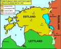 BalticStatesBorders-de.svg 747 × 593; 230 KB
-
 BalticStatesBorders-hu.svg 747 × 593; 178 KB
-
 BalticStatesBorders-ru.svg 721 × 593; 116 KB
-
 BalticStatesBorders.svg 721 × 593; 229 KB
-
 Eesti haldusjaotus 1925.jpg 5,625 × 4,145; 6.9 MB
-
 Estonia 1929-1938.svg 450 × 456; 494 KB
-
 Estonia1925physical hu.svg 800 × 304; 251 KB
-
 Estonia1925physical.jpg 600 × 228; 165 KB
-
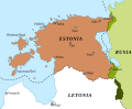
 Lithuania, Latvia and Estonia (1923).JPG 1,809 × 1,357; 2.19 MB
-
 Petseri-1925.jpg 595 × 864; 208 KB
-
 Геополитический статус стран Северной Европы в 1939.jpg 4,855 × 3,501; 1.2 MB


.JPG)

