Category:Maps of Fraser Island
Jump to navigation
Jump to search
Media in category "Maps of Fraser Island"
The following 17 files are in this category, out of 17 total.
-
 Admiralty Chart No 1021 Port Jackson to Fraser Island, Published 1957.jpg 11,222 × 16,336; 42 MB
-
 Admiralty Chart No 1024 Fraser Island to Cumberland Islands, Published 1960.jpg 16,460 × 11,279; 46.59 MB
-
 Admiralty Chart No 1068 Chart of Terra Australis. Sheet III East coast, Published 1814.jpg 11,582 × 7,916; 40.15 MB
-
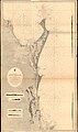 Admiralty Chart No 1068 Moreton Bay to Sandy Cape, Published 1870.jpg 11,079 × 18,802; 71.04 MB
-
 Admiralty Chart No 345 Sandy Cape to Keppel Isles, Published 1959.jpg 18,877 × 11,296; 38.56 MB
-
 Admiralty Chart No 345 Sandy Cape to Keppel Isles, Queensland, Published1863.jpg 14,144 × 10,526; 49.47 MB
-
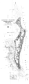 Cad-map-2mile-county-fraser-sh-1913 verkleinert.png 3,330 × 9,551; 4.39 MB
-
 Cad-map-2mile-county-fraser-sh-1913.png 6,659 × 19,694; 7.36 MB
-
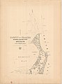 Cad-map-2mile-county-fraser-sh1-1913.jpg 8,879 × 11,998; 7.74 MB
-
 Cad-map-2mile-county-fraser-sh2-1913.jpg 8,857 × 11,998; 9.03 MB
-
 Fraser Island location map.png 678 × 881; 22 KB
-
 Fraser island locator map.svg 512 × 393; 22 KB
-
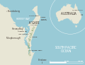
 Fraser island locator map2.jpg 660 × 506; 77 KB
-
 Fraser Island southwest Topo Map 1942.jpg 5,000 × 3,432; 10.89 MB
-
 Fraser Island Topo Map 1942.jpg 5,000 × 6,306; 13.73 MB
-
 Fraser Island.PNG 660 × 506; 14 KB
-
 Fraseri saar.png 660 × 506; 45 KB


