Category:Maps of Grainger County, Tennessee
Jump to navigation
Jump to search
Counties of Tennessee: Anderson · Bedford · Benton · Bledsoe · Blount · Bradley · Campbell · Cannon · Carroll · Carter · Cheatham · Chester · Claiborne · Clay · Cocke · Coffee · Crockett · Cumberland · Davidson · Decatur · DeKalb · Dickson · Dyer · Fayette · Fentress · Franklin · Gibson · Giles · Grainger · Greene · Grundy · Hamblen · Hamilton · Hancock · Hardeman · Hardin · Hawkins · Haywood · Henderson · Henry · Hickman · Houston · Humphreys · Jackson · Jefferson · Johnson · Knox · Lake · Lauderdale · Lawrence · Lewis · Lincoln · Loudon · Macon · Madison · Marion · Marshall · Maury · McMinn · McNairy · Meigs · Monroe · Montgomery · Moore · Morgan · Obion · Overton · Perry · Pickett · Polk · Putnam · Rhea · Roane · Robertson · Rutherford · Scott · Sequatchie · Sevier · Shelby · Smith · Stewart · Sullivan · Sumner · Tipton · Trousdale · Unicoi · Union · Van Buren · Warren · Washington · Wayne · Weakley · White · Williamson · Wilson
| NO WIKIDATA ID FOUND! Search for Maps of Grainger County, Tennessee on Wikidata | |
| Upload media |
Media in category "Maps of Grainger County, Tennessee"
The following 11 files are in this category, out of 11 total.
-
 East Tennessee Crossing Byway sign.jpg 3,264 × 2,448; 1.03 MB
-

-

-

-
 Joppa-Map.png 1,678 × 1,066; 3.07 MB
-
 Knoxville-Sevierville-La Follette CSA.png 625 × 173; 23 KB
-
 Map of Grainger County, Tennessee With Municipal and Township Labels.jpg 1,143 × 1,064; 159 KB
-
 Map of Tennessee highlighting Grainger County.svg 7,814 × 1,916; 98 KB
-
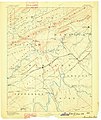
 Morristown, TN Sheet USGS 1883 (cropped).jpg 1,139 × 1,021; 476 KB
-
 Morristown, TN Sheet USGS 1883.jpg 2,532 × 3,016; 1.88 MB
-
 Tennessee Senate District 8 (2010).png 3,507 × 2,010; 464 KB


.jpg)

.png)