Category:Maps of Graves-Saint-Amant
Jump to navigation
Jump to search
Wikimedia category | |||||
| Upload media | |||||
| Instance of | |||||
|---|---|---|---|---|---|
| Category combines topics | |||||
| Graves-Saint-Amant | |||||
commune in Charente, France  .svg)  | |||||
| Instance of | |||||
| Location |
| ||||
| Located in or next to body of water | |||||
| Population |
| ||||
| Area |
| ||||
| Replaces |
| ||||
 | |||||
Media in category "Maps of Graves-Saint-Amant"
The following 5 files are in this category, out of 5 total.
-
 16297-Graves-Saint-Amant-argile.jpg 3,057 × 2,480; 564 KB
-
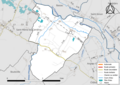 16297-Graves-Saint-Amant-Routes-Hydro.png 3,507 × 2,480; 2.22 MB
-
 16297-Graves-Saint-Amant-Routes-Hydro.svg 1,056 × 744; 3.62 MB
-
 16297-Graves-Saint-Amant-ZNIEFF1.png 5,866 × 4,133; 6.04 MB
-
 16297-Graves-Saint-Amant-ZNIEFF2.png 5,866 × 4,133; 5.95 MB


