Category:Maps of Greece
Aller à la navigation
Aller à la recherche
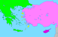
Pays d’Europe : Albanie · Allemagne · Andorre · Arménie‡ · Autriche · Azerbaïdjan‡ · Belgique · Biélorussie · Bosnie-Herzégovine · Bulgarie · Croatie · Chypre‡ · Danemark · Espagne‡ · Estonie · Finlande · France‡ · Géorgie‡ · Grèce · Hongrie · Irlande · Islande · Italie · Kazakhstan‡ · Lettonie · Liechtenstein · Lituanie · Luxembourg · Macédoine du Nord · Malte · Moldavie · Monaco · Monténégro · Norvège · Pays-Bas‡ · Pologne · Portugal‡ · Roumanie · Royaume-Uni · Russie‡ · Saint-Marin · Serbie · Slovaquie · Slovénie · Suède · Suisse · Tchéquie · Turquie‡ · Ukraine · Vatican
Statuts particuliers : Akrotiri et Dhekelia‡ · Gibraltar · bailliage de Guernesey · Jersey · Île de Man · îles Féroé · Svalbard – Reconnaissance limitée : Abkhazie‡ · Chypre du Nord‡ · Gagaouzie · Kosovo · Ossétie du Sud-Alanie‡ · Transnistrie · Zone tampon des Nations unies à Chypre‡
‡ : situé partiellement en Europe
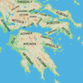
Utilisez la catégorie appropriée pour les cartes montrant la totalité ou une large partie de : Grèce. Utilisez les sous-catégories pour les zones plus petites:
| Si la carte affiche | Catégorie à utiliser |
|---|---|
| Grèce sur une carte récemment créée | Category:Maps of Greece ou ses sous-catégories |
| Grèce sur une carte créée il y a plus de 70 ans | Category:Old maps of Greece ou ses sous-catégories |
| l’histoire de Grèce sur une carte récemment créée | Category:Maps of the history of Greece ou ses sous-catégories |
| l’histoire de Grèce sur une carte créée il y a plus de 70 ans | Category:Old maps of the history of Greece ou ses sous-catégories |
page de catégorie d'un projet Wikimedia | |||||
| Téléverser des médias | |||||
| Nature de l’élément | |||||
|---|---|---|---|---|---|
| Sujets associés à la catégorie | |||||
 | |||||
Sous-catégories
Cette catégorie comprend 65 sous-catégories, dont les 65 ci-dessous.
*
- Maps of Boeotia (3 F)
+
3
- 3D maps of Greece (6 F)
?
A
- Maps of Acarnania (6 F)
- Maps of Acheron (7 F)
- Maps of Aiani (1 F)
B
- Blank maps of Greece (6 F)
C
- Maps of Chech (7 F)
- Maps by Michael Chrysochoos (8 F)
D
E
- ECHO Daily Maps of Greece (40 F)
F
H
I
L
- Location maps of Greece (83 F)
M
O
P
- Maps of Parga (9 F)
R
- Road maps of Greece (59 F)
S
- Sports maps of Greece (3 F)
T
W
Pages dans la catégorie « Maps of Greece »
Cette catégorie comprend 2 pages, dont les 2 ci-dessous.
Média dans la catégorie « Maps of Greece »
Cette catégorie comprend 197 fichiers, dont les 197 ci-dessous.
-
 Preface of Nicolas Gerbelius to Sophianos’s Description of Greece WDL374.png 1 770 × 1 024 ; 2,98 Mio
-
 Kartaferaios.png 500 × 381 ; 126 kio
-
 Χάρτης της Ελλάδος 1826, με αφιέρωση στο πίσω μέρος στον Κάρολο Φαβιέρο, από τον δημιουργό του.jpg 2 104 × 2 820 ; 1,28 Mio
-
 1993 trip of Constantine II of Greece.png 1 623 × 1 445 ; 805 kio
-
 000 Greqia harta.PNG 366 × 350 ; 19 kio
-
 2 digit postcode greece.png 885 × 885 ; 153 kio
-
 2011 Dimos Kato Nevrokopiou.png 800 × 474 ; 96 kio
-
 2014 Greek European election - Municipal Units Results.png 1 512 × 1 368 ; 126 kio
-
 20181115 DailyMap migration crisis CEW.pdf 1 754 × 1 239 ; 752 kio
-
 A90 Map.jpg 772 × 815 ; 165 kio
-
 Aegean Sea region Cropped.jpg 1 383 × 740 ; 260 kio
-
 Aegean Sea region. LOC 2006625576.jpg 7 142 × 6 358 ; 8,18 Mio
-
 Aegean Sea region. LOC 2006625576.tif 7 142 × 6 358 ; 129,92 Mio
-
 AegeanIslands.png 1 276 × 804 ; 19 kio
-
 Agean non political.jpg 1 305 × 890 ; 960 kio
-
 Ambrakian Gulf - Satellite Image Named - DE 01.jpg 4 030 × 4 030 ; 7,38 Mio
-
 Ancient Greek epichoric alphabets (Greek).svg 921 × 776 ; 967 kio
-
 Ancient Greek epichoric alphabets (Indonesian version).svg 921 × 776 ; 962 kio
-
 Ancient Greek southern regions.png 800 × 800 ; 377 kio
-
 Ancient Macedonia within Greece (el).png 1 876 × 1 749 ; 455 kio
-
 Ancient Regions Central Greece-300x300.png 300 × 300 ; 103 kio
-
 Ancient Regions Mainland Greece2-es.svg 1 867 × 1 786 ; 919 kio
-
 Ancient Regions Peloponnese.png 800 × 800 ; 289 kio
-
 Athens International Airport Domestic Destinations.jpg 1 003 × 825 ; 350 kio
-
 Balkans 4087 cut bersko.png 2 690 × 1 537 ; 5,07 Mio
-
 Balkans 4087 cut centralna makedonia.png 8 769 × 4 907 ; 46,71 Mio
-
 Balkans 4087 cut dramsko.png 3 859 × 2 049 ; 11,49 Mio
-
 Balkans 4087 cut grevensko.png 3 191 × 1 461 ; 7,06 Mio
-
 Balkans 4087 cut gyumurdzhinsko.png 3 095 × 1 667 ; 6,55 Mio
-
 Balkans 4087 cut halkidika.png 4 676 × 2 506 ; 7,04 Mio
-
 Balkans 4087 cut iztochna makedonia trakia.png 9 681 × 4 426 ; 45,01 Mio
-
 Balkans 4087 cut kardishko.png 2 989 × 1 796 ; 7,83 Mio
-
 Balkans 4087 cut katerinsko.png 2 040 × 2 056 ; 5,03 Mio
-
 Balkans 4087 cut kavalsko.png 3 296 × 2 191 ; 6,35 Mio
-
 Balkans 4087 cut kostursko.png 2 525 × 2 051 ; 7,56 Mio
-
 Balkans 4087 cut kozhansko.png 3 752 × 2 535 ; 13,68 Mio
-
 Balkans 4087 cut ksantiisko.png 2 622 × 1 921 ; 6,13 Mio
-
 Balkans 4087 cut kukushko.png 3 304 × 1 971 ; 8,79 Mio
-
 Balkans 4087 cut lamiisko.png 5 047 × 2 595 ; 16,21 Mio
-
 Balkans 4087 cut larisko.png 3 510 × 3 505 ; 14,77 Mio
-
 Balkans 4087 cut lerinsko.png 2 924 × 1 461 ; 5,49 Mio
-
 Balkans 4087 cut sersko.png 4 067 × 2 257 ; 12,51 Mio
-
 Balkans 4087 cut solunsko.png 4 220 × 2 231 ; 11,14 Mio
-
 Balkans 4087 cut trikalsko.png 3 626 × 1 833 ; 9,83 Mio
-
 Balkans 4087 cut vodensko.png 3 201 × 1 887 ; 8,15 Mio
-
 Balkans 4087 cut volosko.png 5 922 × 2 092 ; 6,63 Mio
-
 Balkans 4087 cut yaninsko.png 3 277 × 3 595 ; 18,5 Mio
-
 Balkans 4087 cut zapadna makedonia.png 4 672 × 3 637 ; 24,4 Mio
-
 Carpathian Sea modern 2.png 496 × 496 ; 156 kio
-
 Carte parc lagune Missolonghi.png 1 180 × 754 ; 833 kio
-
 Carte parc national Kotychi Strofylia.png 858 × 723 ; 437 kio
-
 Carte parc Schiniás-Marathon.png 1 319 × 670 ; 531 kio
-
 Carte parc Tzoumerka.png 906 × 838 ; 1,01 Mio
-
 Central Greece.png 1 693 × 523 ; 806 kio
-
 Citiesadsf.png 1 600 × 1 253 ; 1,72 Mio
-
 Colònies gregues i fenícies 900-500ane.png 9 999 × 6 868 ; 5,95 Mio
-
 Contre-Offens Grèce Italie (hy).svg 427 × 293 ; 257 kio
-
 Corfu topographic map-en librsvg.png 2 096 × 2 341 ; 2,1 Mio
-
 Corfu topographic map-en rendersvg.png 2 096 × 2 341 ; 2,7 Mio
-

-
 Dafnonas.gif 286 × 302 ; 6 kio
-
 Decentralized Administrations of Greece blank map.png 1 245 × 1 024 ; 235 kio
-
 Dimos-pallinis.jpg 980 × 882 ; 133 kio
-
 Distribution Hellenic Flora Map 2010.jpg 551 × 377 ; 89 kio
-
 Distribution map of Cicadivetta goumenissa - ZooKeys-319-083-g002.jpeg 1 137 × 990 ; 1,13 Mio
-
 ECDM 20200402 South-East Europe Migration.pdf 2 479 × 1 754 ; 1,26 Mio
-
 ECDM 20200424 South-East Europe Migration.pdf 2 479 × 1 754 ; 1,23 Mio
-
 ECDM 20230718 Greece wildfires.pdf 1 625 × 1 125 ; 800 kio
-
 ECHO Greece Editable A4 Landscape 2022.pdf 1 754 × 1 239 ; 381 kio
-
 ECHO Greece Editable A4 Landscape 2022.png 3 509 × 2 482 ; 4,05 Mio
-
 Electrical Power Grid - Greece.png 3 051 × 2 915 ; 952 kio
-
 Elide ru.png 255 × 346 ; 16 kio
-
 Eparxia Eordeas.png 695 × 600 ; 72 kio
-
 Epsilon TV.jpg 840 × 595 ; 369 kio
-
 ETH-BIB-Karte der Kykladen-Dia 247-Z-00210.tif 2 859 × 3 406 ; 27,99 Mio
-
 ETH-BIB-Karte Golf von Patras-Korinth-Aegina-Dia 247-F-00377.tif 2 999 × 3 407 ; 29,4 Mio
-
 ETH-BIB-Karte Korinth-Athen etc., topographisch-Dia 247-Z-00220.tif 3 645 × 3 003 ; 31,46 Mio
-
 Europe Balkans Macedonia geo.jpg 726 × 609 ; 146 kio
-
 Evrotas valley within Laconia.png 560 × 582 ; 803 kio
-
 Field trip to Greece, 2008.png 626 × 536 ; 17 kio
-
 FLII Greece.png 991 × 856 ; 343 kio
-
 Gr-borders map.jpg 564 × 536 ; 233 kio
-
 Gr-map-EU.png 366 × 350 ; 39 kio
-
 Gr-map.png 326 × 350 ; 30 kio
-
 GR-Reg-Gliederung.svg 1 003 × 825 ; 591 kio
-
 Gray Zones 21.png 530 × 596 ; 165 kio
-
 Grcka mapa 2.jpg 456 × 468 ; 249 kio
-
 Grcka mapa.jpg 394 × 600 ; 83 kio
-
 Greater Greece.PNG 525 × 335 ; 5 kio
-
 Grece01.gif 801 × 783 ; 37 kio
-
 Greece - Forest Cover Types - DPLA - 71c956f930f27f6abab863b0e1a2fdd2.jpg 6 342 × 5 318 ; 4,86 Mio
-
 Greece Administrative Division - DPLA - 2ab47b5792019849994e6d23676e679f.jpg 2 556 × 3 276 ; 4,08 Mio
-
 Greece Condition of Road Surfacing, 1946 - DPLA - f83ae8972043ac8805b756e7d9d63cf6.jpg 5 552 × 7 241 ; 3,37 Mio
-
 Greece in V c. B.C.png 4 500 × 4 233 ; 8,16 Mio
-
 Greece Ionian island map (ru).png 1 015 × 1 581 ; 223 kio
-
 Greece island regions map (ru).png 1 500 × 1 911 ; 478 kio
-
 Greece linguistic minorities .png 550 × 600 ; 159 kio
-
 Greece map blank.png 2 000 × 2 000 ; 270 kio
-
 Greece map Chania 1.png 750 × 701 ; 126 kio
-
 Greece map modern 2.png 496 × 496 ; 185 kio
-
 Greece map modern.png 2 000 × 2 000 ; 1,21 Mio
-
 Greece map.png 238 × 216 ; 24 kio
-
 Greece Maps 10-11-14-15-1 - DPLA - 9fc68eab8d2567edbe1012770469ccc1.jpg 8 682 × 7 210 ; 7,29 Mio
-
 Greece Maps 3-4-5-6-7-8-9-12-13 - DPLA - dd998d80290cafcce8961493446083ee.jpg 13 254 × 11 246 ; 16,56 Mio
-
 Greece outline map-2.gif 1 111 × 972 ; 117 kio
-
 Greece outline map.png 800 × 700 ; 15 kio
-
 Greece prefectures map dark.PNG 800 × 700 ; 17 kio
-
 Greece subdivisions-hu-HAM.png 1 024 × 899 ; 299 kio
-
 Greece – U.S. area comparison.jpg 701 × 821 ; 489 kio
-
 Greece-map.png 5 000 × 4 879 ; 4,32 Mio
-
 Greece-satellite-map.jpg 867 × 922 ; 111 kio
-
 Greece.geohive.gif 620 × 513 ; 32 kio
-
 GreeceNaturalGasPipelinesApproximation.png 496 × 496 ; 194 kio
-
 GreeceOMC.png 1 046 × 927 ; 91 kio
-
 GreeceRegionsGerman.svg 564 × 531 ; 130 kio
-
 GreeceRegionsItalian.png 619 × 512 ; 92 kio
-
 GreeceSilhouette.png 300 × 314 ; 12 kio
-
 GreeceWithoutNumbersPerepheries.png 400 × 408 ; 56 kio
-
 Greek Map icon.png 51 × 45 ; 5 kio
-
 Greek nationalism.jpg 4 937 × 3 376 ; 543 kio
-
 Greek regions by HDI.png 1 184 × 881 ; 103 kio
-
 Greek-globus1.gif 531 × 531 ; 487 kio
-
 Grècia.png 5 000 × 4 888 ; 3,28 Mio
-
 Gulf of Corinth fault map with 1861 EQ epicentre.png 3 492 × 1 531 ; 3,78 Mio
-
 Hellas.svg 565 × 487 ; 199 kio
-
 Historická území Řecka.png 559 × 507 ; 95 kio
-
 HoNH map Chalkidiki.png 360 × 202 ; 25 kio
-
 Ionian Islands Pos.png 1 108 × 1 139 ; 215 kio
-
 Kallikratis dioikisi (updated).png 1 511 × 1 370 ; 102 kio
-
 Kap Malea.png 366 × 392 ; 61 kio
-
 Katastimata-Hellenic-duty-free.jpg 1 140 × 1 023 ; 134 kio
-
 Kinal2021.png 1 024 × 842 ; 199 kio
-
 Kozniçe Drama.png 883 × 612 ; 356 kio
-
 Lepanto map.png 723 × 593 ; 135 kio
-
 Lignite Greece.jpg 490 × 511 ; 46 kio
-
 Literacy in Greece (1928).svg 7 460 × 7 505 ; 1,72 Mio
-
 Lojrat Panhelenike.jpg 370 × 296 ; 45 kio
-
 LSDM Carte.png 1 356 × 1 083 ; 380 kio
-
 Macedònia i Grècia.png 5 000 × 4 888 ; 3,31 Mio
-
 Map Greece Megali Idea (hy).png 868 × 624 ; 111 kio
-
 Map Greece Megali Idea 1919 el.jpg 300 × 302 ; 37 kio
-
 Map of Cyprus, Greece and Turkey.svg 725 × 400 ; 36 kio
-
 Map of traditional villages in Greece.png 705 × 562 ; 75 kio
-
 Map of Vathi region.png 457 × 458 ; 96 kio
-
 Map pl.gif 330 × 329 ; 10 kio
-
 Map venetian archipelago.png 1 358 × 946 ; 1,84 Mio
-
 Map-ETV-Kalypsi.jpg 1 165 × 825 ; 348 kio
-
 Map-Hellenic-duty-free-shops.jpg 208 × 279 ; 29 kio
-
 Map-tanker-trade-route-to-lakonikos.png 629 × 477 ; 260 kio
-
 Mapa de la isla de Tafos.gif 331 × 355 ; 29 kio
-
 MapGRim Epirus.png 331 × 433 ; 93 kio
-
 MapZ.png 1 003 × 825 ; 231 kio
-
 MarEgeo.PNG 3 508 × 2 550 ; 161 kio
-
 Meglena Valley.jpg 308 × 254 ; 15 kio
-
 Micenes.png 885 × 653 ; 261 kio
-
 Nördliche Sporaden topo.png 1 000 × 634 ; 816 kio
-
 Old and new names of Drama not far villages.jpg 576 × 960 ; 133 kio
-
 Old and new names of Drama villages.jpg 960 × 576 ; 138 kio
-
 Parnitha satellite map-fr.jpg 1 100 × 900 ; 411 kio
-
 PAT - Greece.gif 950 × 900 ; 248 kio
-
 Pelasgian presence in ancient texts (English).svg 994 × 793 ; 796 kio
-
 Pelophylax cerigensis dis2.png 482 × 346 ; 10 kio
-
 Peloponnes3.png 1 044 × 816 ; 370 kio
-
 Peloponnesbea2a.png 1 044 × 816 ; 346 kio
-
 Peloponnesbea2aar.png 1 044 × 816 ; 313 kio
-
 Petalii.png 1 000 × 645 ; 163 kio
-
 Petra Macedònia Grècia.jpg 327 × 272 ; 15 kio
-
 Photo of a sign at the entrance to the Tomb of the Athenians, Marathon, Greece.jpg 3 113 × 3 083 ; 1,99 Mio
-
 Plaque Gerster's House in Košice.jpg 2 048 × 1 536 ; 709 kio
-
 Population density of Greece regions.png 4 400 × 4 629 ; 796 kio
-
 Prefectures-of-Greece-(Περιφέρειες-της-Ελλάδας).gif 869 × 817 ; 326 kio
-
 Prespalakesregion.svg 744 × 1 052 ; 398 kio
-
 Pékin Express S14 (Grèce).png 806 × 890 ; 246 kio
-
 Regional units of Greece blank.svg 911 × 768 ; 1,51 Mio
-
 Regions of Greece blank.svg 1 003 × 825 ; 744 kio
-
 Saronic.png 2 467 × 2 160 ; 806 kio
-

-

-
 The iliad of Homer. Translated by Alexander Pope, Esq; Fleuron T090946-26.png 2 165 × 1 851 ; 219 kio
-
 Thermopylae map 480bc-el.png 680 × 523 ; 78 kio
-
 Topographic.png 1 180 × 962 ; 569 kio
-
 Tracia osma medium.png 824 × 519 ; 334 kio
-
 Un-greece.png 3 039 × 2 403 ; 2,05 Mio
-
 Via egnatia wolof.jpg 1 600 × 647 ; 387 kio
-
 Vikos location map.png 310 × 255 ; 43 kio
-
 Yunanistan genislemesi.gif 728 × 623 ; 347 kio
-
 Yunanistan Türkleri Ve Oranları.png 3 482 × 3 234 ; 716 kio
-
 Zwgr.jpg 784 × 661 ; 62 kio
-
 Explorated Oilfields in Greece.jpg 400 × 329 ; 38 kio
-
 Καθολική Διαίρεση Ελλάδος.png 803 × 696 ; 119 kio
-
 Καλλικώς ἐν Ἑλλάδι.png 1 003 × 826 ; 221 kio
-
 Καταγραφή.png 633 × 450 ; 113 kio
-
 ΥμηττόςFr.jpg 1 003 × 825 ; 833 kio
-
 Υτρυυτ.png 1 200 × 987 ; 223 kio
-
 Сивиллы древнего мира.jpg 587 × 359 ; 62 kio
-
 Հունաստանի ռազմակալումը Երկրորդ աշխարհամարտում.png 794 × 770 ; 161 kio
-
 חנויותפובליק.png 440 × 385 ; 129 kio


.svg)
.svg)

.png)


.svg)


.png)
.png)


.png)


.svg)


.png)


.svg)


.gif)

.png)


