Category:Maps of Norway
Jump to navigation
Jump to search
Wikimedia category | |||||
| Upload media | |||||
| Instance of | |||||
|---|---|---|---|---|---|
| Category combines topics | |||||
 | |||||
Subcategories
This category has the following 45 subcategories, out of 45 total.
- Location maps of Norway (74 F)
*
B
- Maps of borders of Norway (20 F)
C
D
E
F
G
H
- HDI maps of Norway (2 F)
I
L
M
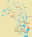
- Maps of rivers of Norway (3 F)
N
P
S
- Storegga maps (5 F)
T
W
Pages in category "Maps of Norway"
The following 3 pages are in this category, out of 3 total.
Media in category "Maps of Norway"
The following 115 files are in this category, out of 115 total.
-
20220308 Modules deployed 2021.pdf 1,625 × 1,125; 961 KB
-
A-K maskiner Norge.png 494 × 496; 66 KB
-
Askdsfsfde.png 1,102 × 600; 168 KB
-
Borgund-Lage.JPG 129 × 182; 7 KB
-
BOTN stedsnavn i Norge.jpg 785 × 993; 124 KB
-
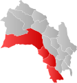
Buskerudbyen i Viken.svg 700 × 753; 29 KB
-
Drammensvassdraget 23.png 509 × 587; 69 KB
-
ECDM 20151209 World Events.pdf 1,625 × 1,125; 566 KB
-
ECDM 2019 Arctic Wildfires.pdf 1,625 × 1,125; 1.17 MB
-
Electrical Power Grid - Norway.png 6,714 × 3,502; 2.35 MB
-
FLII Norway.png 855 × 848; 235 KB
-
Fønnebø kart Plankeveien.jpg 2,499 × 2,168; 910 KB
-
Gaulardal in Norway.png 655 × 573; 403 KB
-
Gefechte bei Dombas.jpg 1,266 × 814; 232 KB
-
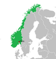
Greater Norway.png 1,744 × 1,234; 66 KB
-
Haldenregionen.svg 285 × 395; 63 KB
-
Hallingdal.svg 700 × 753; 29 KB
-
Haudegen.png 2,294 × 1,865; 1.34 MB
-
Helgelandsk kart.jpg 1,609 × 1,887; 383 KB
-
Indre og Ytre Østfold.svg 302 × 403; 67 KB
-
Indre Østfold.svg 285 × 395; 63 KB
-
Kanalplan Kystradio Sør.jpg 561 × 795; 159 KB
-
Karmoy location.png 433 × 456; 220 KB
-
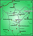
KART Landsverk-gruvene.jpg 2,259 × 2,505; 1.39 MB
-
Kart over Velfjord.jpg 626 × 582; 51 KB
-
Kart-fraa-web.jpg 184 × 244; 65 KB
-
Kart.jpg 350 × 1,274; 113 KB
-
Karte der Stabkirchen in Norwegen.png 688 × 1,059; 157 KB
-
Klostergata 6 SkyView.png 756 × 460; 313 KB
-
Kraftverkene i Orkla.jpg 4,177 × 6,049; 8.04 MB
-
Langfjella.jpg 462 × 565; 203 KB
-
Langfoss-kartutsnitt.png 714 × 705; 899 KB
-
Languages of Norway.png 3,200 × 4,400; 1.04 MB
-
Lillenes-jsv-1893.tif 1,085 × 1,537; 6.92 MB
-
Lokalitetskonsentrasjoner fra Fosna-tid (10 000-8000 f.Kr.) i Norge.jpg 915 × 1,098; 262 KB
-
Lokalitetsområder fra Fosna-Komsa-tid i Norge (10 000-8000 f.Kr.).jpg 915 × 1,098; 263 KB
-
Lokalitetsområder fra Fosna-tid i Norge (10 000-8000 f.Kr.).jpg 915 × 1,098; 262 KB
-
Major regions of Norway.svg 548 × 587; 467 KB
-
MAP Evje-Iveland-Norway.jpg 1,876 × 1,738; 882 KB
-
MAP Evje-Norway.jpg 1,876 × 1,738; 880 KB
-
MAP Iveland-Norway.jpg 1,876 × 1,738; 885 KB
-
Map of Okstinder - DPLA - d50ea4676655d70e9383ea6826c88c33.jpg 5,508 × 7,721; 4.19 MB
-
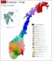
Mapa geopolític de Noruega.png 1,920 × 2,902; 967 KB
-
Midt-Buskerud.svg 700 × 753; 29 KB
-
Midt-helgelandsk.jpg 1,497 × 1,349; 392 KB
-
Midthelgelandsk.png 818 × 1,056; 125 KB
-
MidtPaaE6.jpg 796 × 905; 197 KB
-
Mosseregionen.svg 285 × 395; 63 KB
-
MS Northguider.gif 1,054 × 600; 166 KB
-
N5000 fylker med hav.jpg 2,550 × 3,300; 1.03 MB
-
N5000 skog vann.jpg 2,245 × 2,806; 1.29 MB
-
Nedbør mandag 7. august 2023.png 2,094 × 2,114; 1.75 MB
-
Nedre Buskerud.svg 700 × 753; 29 KB
-
Nedre Glomma.svg 285 × 395; 63 KB
-
Nedre Romerike.svg 384 × 507; 47 KB
-
NEED-North Norway.jpg 1,658 × 1,542; 590 KB
-
Nidelvassdraget map.png 1,485 × 1,179; 114 KB
-
Nordland Norway 751 pan crop 15 (29693311483).jpg 7,913 × 10,070; 41.39 MB
-
Nordsee-Einzugsgebiete-Norwegen.png 2,079 × 1,725; 1.27 MB
-
Norge-map.png 5,000 × 5,915; 6.68 MB
-
Norges Kart Post-Trøndelag.png 393 × 473; 728 KB
-
Norges nye politidistrikter fra 2016.jpg 693 × 893; 86 KB
-
Normannsløkka plan.jpg 2,000 × 1,124; 482 KB
-
NorskaRännan.png 572 × 700; 160 KB
-
Norske daler1.JPG 408 × 474; 20 KB
-
Norske daler2.JPG 408 × 474; 20 KB
-
Northeast Atlantic bathymetry.png 413 × 323; 347 KB
-
Northguide’s rute.jpg 2,871 × 2,762; 3.7 MB
-
Norway - DPLA - 114c98881e68aebd39e8e08c3fda411b.jpg 2,790 × 3,560; 10.26 MB
-
Norway - DPLA - 84e837871fda37b99ef42d2456d7f306.jpg 2,540 × 3,268; 6.07 MB
-
Norway - DPLA - f440b4508679094c241fc02c94b304a7.jpg 2,544 × 3,268; 6.29 MB
-
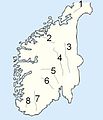
Norway 5 unofficial regions map.png 2,420 × 2,168; 523 KB
-
Norway districts.svg 2,105 × 2,980; 1.91 MB
-
Norway DNI Solar-resource-map GlobalSolarAtlas World-Bank-Esmap-Solargis.png 2,598 × 1,842; 3.09 MB
-
Norway during the reign of Magnus the Good.png 1,920 × 1,453; 271 KB
-
Norway GHI Solar-resource-map GlobalSolarAtlas World-Bank-Esmap-Solargis.png 2,598 × 1,842; 2.97 MB
-
Norway PVOUT Photovoltaic-power-potential-map GlobalSolarAtlas World-Bank-Esmap-Solargis.png 2,598 × 1,842; 2.91 MB
-
Norway Telephone Area Code.jpg 1,500 × 1,623; 224 KB
-
Norway Vestfold - Tønsberg (2020).png 523 × 674; 130 KB
-
Norway Åmnesfossenloc.png 295 × 316; 46 KB
-
Norway-equidist.png 3,235 × 2,601; 129 KB
-
Norway.hynor.hydrogen.highway.jpg 433 × 456; 287 KB
-
Norwegian Regions.png 3,931 × 4,668; 3.59 MB
-
Numedal og Sandsvær.svg 700 × 753; 29 KB
-
Operational Navigation Chart A-2, 2nd edition.jpg 9,254 × 6,659; 13.7 MB
-
Operational Navigation Chart B-2, 3rd edition.jpg 9,254 × 6,716; 13.42 MB
-
Oslo.png 607 × 639; 56 KB
-
PAT - Norway.gif 800 × 1,035; 247 KB
-
Polarsirkelen i Norge.jpg 3,679 × 1,561; 964 KB
-
Population density of Norway counties.png 2,640 × 4,555; 780 KB
-
Regions Ostfold.png 393 × 473; 13 KB
-
Reproducció d'un mapa de Noruega.jpeg 331 × 768; 67 KB
-
Rutebok for Norge - Rutebokens Norgeskart.jpg 3,648 × 2,736; 6.43 MB
-
Samar-i-sør14.jpg 780 × 965; 846 KB
-
Sanntid i Norge.png 2,654 × 1,418; 1.73 MB
-
Setesdal map.jpg 1,200 × 1,221; 560 KB
-
Sheet XXXIV-45 1st Edition - DPLA - 4f1b508301cca080e8c15086607c1683.JPG 7,200 × 5,415; 6.31 MB
-
Sketch Map- Coast of Norway (3613057191).jpg 2,931 × 5,156; 1.08 MB
-
Sørsamiske reinbeitedistrikt sitje Nordland Trøndelag.jpg 841 × 1,190; 403 KB
-
Tetraterm annual 1961-1990.png 900 × 1,100; 216 KB
-
Tetraterm annual 1991-2020.png 900 × 1,100; 219 KB
-
Tetraterm-change diff 91-20-61-90.png 900 × 1,100; 155 KB
-
Tettstedutstrekning i sentrale Valdres.png 815 × 944; 122 KB
-
Tides in Norway.png 1,225 × 2,510; 113 KB
-
TourNorway2019.png 775 × 631; 172 KB
-
Turistkart for norskekysten (24862622711).jpg 1,276 × 12,800; 24.45 MB
-
Tønsbergregionen.svg 218 × 369; 24 KB
-
Valvatna Kart.png 2,128 × 1,024; 3.74 MB
-
Vefsnmål område.jpg 1,097 × 830; 218 KB
-
Vestland.gif 561 × 695; 93 KB
-
Як дістатись Trollstigen Cafe.gif 450 × 312; 66 KB
-
حيّ ڤيندرن فِي مَدينة أُوسْلُو عَاصِمة مَملَكةُ النُّروِيج.jpg 1,272 × 2,480; 162 KB


