Category:Maps of Harford County, Maryland
Jump to navigation
Jump to search
Counties of Maryland: Allegany · Anne Arundel · Baltimore · Calvert · Caroline · Carroll · Cecil · Charles · Dorchester · Frederick · Garrett · Harford · Howard · Kent · Montgomery · Prince George's · Queen Anne's · Somerset · St. Mary's · Talbot · Washington · Wicomico · Worcester · Independent city:
Wikimedia category | |||||
| Upload media | |||||
| Instance of | |||||
|---|---|---|---|---|---|
| Category combines topics | |||||
| Harford County | |||||
county in Maryland, United States     | |||||
| Instance of | |||||
| Part of | |||||
| Named after |
| ||||
| Location | Maryland | ||||
| School district | |||||
| Capital | |||||
| Inception |
| ||||
| Population |
| ||||
| Area |
| ||||
| Different from | |||||
| official website | |||||
 | |||||
Media in category "Maps of Harford County, Maryland"
The following 29 files are in this category, out of 29 total.
-
 Aberdeen Proving Ground Airspace Reservation EO 5211 illustration.jpg 4,288 × 2,654; 931 KB
-
 Baltimore-Towson Metropolitan Area.png 566 × 311; 22 KB
-

-

-

-

-

-

-

-

-

-

-

-

-

-
 Harford.svg 543 × 353; 274 KB
-
 Havre de Grace 1907.jpg 1,756 × 1,572; 702 KB
-
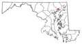
 Map of Maryland highlighting Harford County.svg 3,858 × 2,019; 139 KB
-
 MD Scenic Byway 10, Lower Susquehanna Map.png 1,300 × 1,050; 218 KB
-
 MDMap-doton-BelAir.PNG 300 × 162; 10 KB
-
 MDMap-doton-Edgewood.PNG 300 × 162; 10 KB
-
 MDMap-doton-Fallston.PNG 300 × 162; 10 KB
-
 MDMap-doton-HavreDeGrace.PNG 300 × 162; 10 KB
-
 MDMap-doton-Jarrettsville.PNG 300 × 162; 10 KB
-
 MDMap-doton-Joppatowne.PNG 300 × 162; 10 KB
-
 MDMap-doton-Perryman.PNG 300 × 162; 10 KB
-
 MDMap-doton-PleasantHills.PNG 300 × 162; 10 KB
-
 Plat of Joppa in 1725.png 740 × 1,454; 271 KB
-
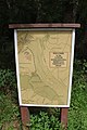 Sign for Lower Susquehanna Heritage Greenway Trail (2022).jpg 2,304 × 3,456; 3.2 MB


.jpg)