Category:Maps of Kastellorizo
Jump to navigation
Jump to search
Subcategories
This category has only the following subcategory.
M
Media in category "Maps of Kastellorizo"
The following 12 files are in this category, out of 12 total.
-
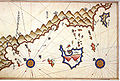 Kas and Kastelorizo by Piri Reis.jpg 812 × 545; 575 KB
-
 2011 Dimos Megistis.png 2,000 × 1,253; 249 KB
-
 Admiralty Chart No 2188 Ports and Anchorages on the South Coast of Turkey, Published 1964.jpg 16,344 × 11,259; 21.82 MB
-
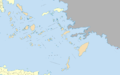
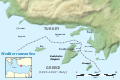
 Dimos Megistis.png 800 × 609; 69 KB
-
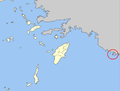
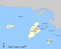
 GR-Dodekanes-kastellorizo.png 1,080 × 1,062; 238 KB
-
 Kastelorizo-es.svg 920 × 614; 1.19 MB
-
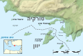 Kastelorizo-HE.svg 920 × 614; 643 KB
-
 Kastelorizo-nb.svg 920 × 614; 647 KB
-
 Kastelorizo.png 1,000 × 800; 62 KB
-
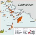
 Kastelorizo.svg 920 × 614; 647 KB
-
 Meis–Kaş Swim route map.png 844 × 613; 316 KB
-
 Meyisti.png 587 × 381; 58 KB


