Category:Maps of Landkreis Wesermarsch
Jump to navigation
Jump to search
Subcategories
This category has only the following subcategory.
Media in category "Maps of Landkreis Wesermarsch"
The following 9 files are in this category, out of 9 total.
-
 Aufenthaltsbereich des Fort Stollhammerdeich.png 2,728 × 1,259; 1.14 MB
-
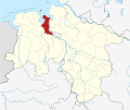
 BRA in Niedersachsen.svg 1,121 × 978; 147 KB
-
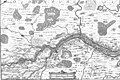 Karte Unterweser.jpg 3,250 × 2,158; 3.93 MB
-
 Lage des Landkreises Wesermarsch in Deutschland.GIF 176 × 234; 3 KB
-
 Locator map BRA in Germany.svg 1,075 × 1,273; 535 KB
-
 Locator map BRA in Lower Saxony.svg 1,424 × 1,203; 322 KB
-
 Lower saxony bra.png 280 × 245; 13 KB
-
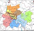
 SeefeldLandschaftsgeschichte.png 1,995 × 1,620; 3.56 MB
-
 WK Verbreitungsgebiet.jpeg 711 × 633; 103 KB


