Category:Maps of Leicester
Jump to navigation
Jump to search
English: Maps of Leicester
Wikimedia category | |||||
| Upload media | |||||
| Instance of | |||||
|---|---|---|---|---|---|
| Category combines topics | |||||
| Leicester | |||||
city in Leicestershire, East Midlands, England   | |||||
| Pronunciation audio | |||||
| Instance of | |||||
| Location | City of Leicester, Leicestershire, East Midlands, England | ||||
| Located in or next to body of water | |||||
| Official language | |||||
| Head of government |
| ||||
| Population |
| ||||
| Area |
| ||||
| Elevation above sea level |
| ||||
| Different from | |||||
| official website | |||||
 | |||||
Media in category "Maps of Leicester"
The following 46 files are in this category, out of 46 total.
-
 African Leicester 2011 census.png 16,355 × 17,552; 7.06 MB
-
 Arab Leicester 2011 census.png 16,355 × 17,552; 6.92 MB
-
 Asian Leicester 2011 census.png 16,355 × 17,552; 9.5 MB
-
 Bangladeshi Leicester 2011 census.png 16,409 × 17,585; 9.67 MB
-
 Black Leicester 2011 census.png 16,409 × 17,610; 9.31 MB
-
 British Leicester 2011 census.png 16,409 × 17,585; 9.35 MB
-
 Buddhism Leicester 2011 census.png 16,355 × 17,552; 9.83 MB
-
 Caribbean Leicester 2011 census.png 16,355 × 17,551; 9.84 MB
-
 Chinese Leicester 2011 census.png 16,409 × 17,610; 9.72 MB
-
 Christianity Leicester 2011 census.png 16,355 × 17,552; 9.59 MB
-
 EnglandLeicester.png 200 × 247; 28 KB
-
 EnglandLeicester3.PNG 200 × 247; 19 KB
-
 Greyfriars, Leicester location map.gif 501 × 500; 112 KB
-
 Greyfriars, Leicester site de-Kopie.svg 839 × 795; 121 KB
-
 Greyfriars, Leicester site-fr.svg 1,650 × 1,579; 33 KB
-
 Greyfriars, Leicester site-zh.svg 1,650 × 1,579; 87 KB
-
 Greyfriars, Leicester site.gif 1,655 × 1,310; 651 KB
-
 Greyfriars, Leicester site.svg 1,650 × 1,579; 148 KB
-
 Hinduism Leicester 2011 census.png 16,409 × 17,610; 9.63 MB
-
 Indian Leicester 2011 census.png 16,355 × 17,552; 9.53 MB
-
 Leicester city boundary map overlay.svg 1,045 × 1,145; 3 KB
-
 Leicester city boundary map tinted overlay.svg 1,045 × 1,145; 6 KB
-
 Leicester UK locator map.svg 1,425 × 1,123; 1,021 KB
-
 Leicester UK ward map 2010 (blank).svg 1,097 × 1,266; 271 KB
-
 Leicester UK ward map 2015 (blank).svg 1,097 × 1,266; 295 KB
-
 Leicester Urban Area 1981.svg 1,375 × 1,375; 49 KB
-
 Leicester Urban Area 1991.svg 1,375 × 1,375; 54 KB
-
 Leicester-BUA-2011.jpg 958 × 946; 125 KB
-
 LeicesterBeaumontLeysWard.svg 2,000 × 2,308; 288 KB
-
 LeicesterBraunstoneParkRowleyFieldsWard.svg 2,000 × 2,308; 288 KB
-
 LeicesterCharnwoodWard.svg 2,000 × 2,308; 288 KB
-
 LeicesterColemanWard.svg 2,000 × 2,308; 288 KB
-
 LeicesterEyresMonsellWard.svg 2,000 × 2,308; 288 KB
-
 LeicesterHumberstoneHamiltonWard.svg 2,000 × 2,308; 288 KB
-
 LeicesterLatimerWard.png 2,000 × 2,308; 189 KB
-
 LeicesterNewParksWard.svg 2,000 × 2,308; 288 KB
-
 LeicesterRusheyMeadWard.svg 2,000 × 2,308; 288 KB
-
 Leicestershire-lockdown-boundary-map.jpg 1,106 × 1,087; 1.18 MB
-
 LeicesterThurncourtWard.svg 2,000 × 2,308; 288 KB
-
 LeicesterUrbanArea.svg 657 × 585; 288 KB
-
 Location map United Kingdom Leicester Central.png 1,978 × 2,019; 2.71 MB
-
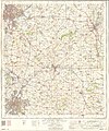
 Ordnance Survey One-Inch Sheet 121 Derby & Leicester, Published 1962 2.jpg 8,622 × 10,685; 19.98 MB
-
 Ordnance Survey One-Inch Sheet 121 Derby & Leicester, Published 1962.jpg 8,288 × 9,900; 11.78 MB
-
 Ordnance Survey One-Inch Sheet 122 Melton Mowbray, Published 1962.jpg 8,294 × 9,920; 11.13 MB
-
 Ordnance Survey Sheet SK 60 70 Leicester (East), Published 1971.jpg 14,718 × 6,978; 29.09 MB
-
 Stoneygate, Leicester, conservation area map.svg 470 × 600; 4 KB


,_Published_1971.jpg)

.svg)
.svg)