Category:Maps of Loury
Jump to navigation
Jump to search
Wikimedia category | |||||
| Upload media | |||||
| Instance of | |||||
|---|---|---|---|---|---|
| Category combines topics | |||||
| Loury | |||||
commune in Loiret, France    | |||||
| Instance of | |||||
| Location |
| ||||
| Population |
| ||||
| Area |
| ||||
| official website | |||||
 | |||||
Subcategories
This category has the following 2 subcategories, out of 2 total.
A
- Administrative maps of Loury (4 F)
G
- Geological maps of Loury (7 F)
Media in category "Maps of Loury"
The following 8 files are in this category, out of 8 total.
-
 45 Znieff 178.jpg 5,457 × 3,543; 1.21 MB
-
 45-Loury-Routes.png 5,457 × 3,543; 2.27 MB
-
 45188-Loury-argile.png 3,057 × 2,480; 2.56 MB
-
 45188-Loury-Cours eau.jpg 3,507 × 2,480; 460 KB
-
 45188-Loury-Hydro.jpeg 5,846 × 4,133; 1.95 MB
-
 45188-Loury-Orthophoto.jpeg 10,559 × 7,440; 12.08 MB
-
 45188-Loury-Sols.png 3,519 × 2,480; 2.09 MB
-
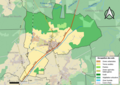
 Map commune FR insee code 45188.png 756 × 605; 60 KB


