Category:Maps of Marijampolė Municipality
Jump to navigation
Jump to search
Subcategories
This category has the following 3 subcategories, out of 3 total.
M
- Maps of Marijampolė (4 F)
- Marijampolė in maps (6 F)
Media in category "Maps of Marijampolė Municipality"
The following 6 files are in this category, out of 6 total.
-
 Marijampole dst.svg 1,000 × 800; 717 KB
-
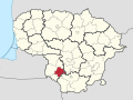 Marijampole in Lithuania.svg 1,095 × 821; 524 KB
-
 Marijampole mun location.png 623 × 503; 20 KB
-
 Marijampole mun location.svg 1,095 × 821; 115 KB
-
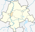
 Marijampoles zemelapis.png 793 × 726; 126 KB
-
 Marijampolės savivaldybė.svg 1,142 × 1,052; 198 KB


