Category:Maps of Nanteuil-lès-Meaux
Jump to navigation
Jump to search
Wikimedia category | |||||
| Upload media | |||||
| Instance of | |||||
|---|---|---|---|---|---|
| Category combines topics | |||||
| Nanteuil-lès-Meaux | |||||
commune in Seine-et-Marne, France  .svg)  | |||||
| Instance of | |||||
| Location |
| ||||
| Located in or next to body of water | |||||
| Head of government |
| ||||
| Population |
| ||||
| Area |
| ||||
| official website | |||||
 | |||||
Media in category "Maps of Nanteuil-lès-Meaux"
The following 12 files are in this category, out of 12 total.
-
 2e volume de l'atlas de Trudaine pour la généralité de Paris - btv1b59695907 (19 of 26).jpg 9,984 × 6,680; 8.26 MB
-
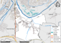
 77330-Nanteuil-lès-Meaux - Localisation.png 2,500 × 2,480; 1.42 MB
-
 77330-Nanteuil-lès-Meaux - Relief-PlanIgn.png 7,015 × 4,960; 13.68 MB
-
 77330-Nanteuil-lès-Meaux-Cadastre.png 7,015 × 4,960; 11.76 MB
-
 77330-Nanteuil-lès-Meaux-Géologie.png 7,015 × 4,960; 5.96 MB
-
 77330-Nanteuil-lès-Meaux-Hydro.png 7,015 × 4,960; 8.3 MB
-
 77330-Nanteuil-lès-Meaux-Natura 2000.png 7,015 × 4,960; 4.68 MB
-
 77330-Nanteuil-lès-Meaux-Orthophoto.png 7,015 × 4,960; 5.87 MB
-
 77330-Nanteuil-lès-Meaux-Sols.png 7,015 × 4,960; 5.36 MB
-
 77330-Nanteuil-lès-Meaux-ZNIEFF1.png 7,015 × 4,960; 4.91 MB
-
 77330-Nanteuil-lès-Meaux-ZNIEFF2.png 7,015 × 4,960; 4.64 MB
-
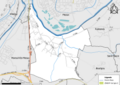
 Map commune FR insee code 77330.png 756 × 605; 56 KB
.jpg)


