Category:Maps of Native American tribal territories
Jump to navigation
Jump to search
Subcategories
This category has the following 58 subcategories, out of 58 total.
A
- Aleut maps (6 F)
- Algonquin maps (7 F)
- Apache maps (24 F)
B
- Blackfoot maps (3 F)
C
- Calusa maps (7 F)
- Cheyenne maps (8 F)
- Choctaw maps (41 F)
- Chumash maps (12 F)
- Comanche maps (15 F)
- Cree maps (14 F)
- Crow maps (12 F)
- Cupeño maps (6 F)
E
- Esselen maps (4 F)
H
- Handbook of North American Indians (262 F)
- Hidatsa maps (15 F)
- Hopi maps (20 F)
I
- Maps of the Iroquois (51 F)
K
- Maps of the Kwakwaka'wakw (8 F)
L
- Lenape maps (23 F)
M
- Maidu maps (8 F)
- Miami maps (11 F)
- Miwok maps (16 F)
- Miꞌkmaq maps (13 F)
- Muscogee maps (41 F)
N
- Nipmuc maps (3 F)
- Nootka Tribal Territories (14 F)
O
- Ohlone maps (14 F)
- Osage maps (13 F)
P
- Paiute maps (6 F)
- Pawnee maps (13 F)
- Pequot maps (4 F)
- Pomo maps (9 F)
S
- Sac and Fox maps (6 F)
- Seminole maps (17 F)
- Shawnee maps (15 F)
- Shoshone maps (14 F)
T
- Trail of Tears maps (8 F)
U
- Ute maps (7 F)
W
- Wampanoag maps (8 F)
Y
- Yokuts maps (10 F)
- Yurok maps (37 F)
Z
- Zuni maps (5 F)
Media in category "Maps of Native American tribal territories"
The following 200 files are in this category, out of 379 total.
(previous page) (next page)-
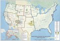
 Bia-map-indian-reservations-usa.png 3,124 × 2,200; 457 KB
-
 Indian Lands of Federally Recognized Tribes of the US, June 2016.pdf 7,050 × 4,797; 5.19 MB
-
 Early indian west.jpg 1,559 × 2,000; 625 KB
-
 Early indian east.jpg 1,664 × 2,000; 617 KB
-

-

-
 1732 map of Louisiana.gif 640 × 480; 274 KB
-
 1732 map of Louisiana.jpg 9,482 × 5,386; 11.85 MB
-

-

-

-
 1815m4.jpg 1,689 × 1,442; 147 KB
-
 1825 Prairie du Chien Line.jpg 1,275 × 1,650; 495 KB
-
 Indian Country-Territory 1834.jpg 949 × 551; 78 KB
-
 Map of Indian territory 1836.png 7,477 × 9,136; 92.32 MB
-

-
 1855 Colton Map of Missouri - Geographicus - Missouri-colton-1855.jpg 4,000 × 3,310; 3.79 MB
-
 1865 Comanche-Kiowa-Apache.png 948 × 523; 961 KB
-
 1867 Comanche-Kiowa-KiowaApache.png 948 × 523; 952 KB
-
 (1885) Ethnographische Karte, das Gebiet der TLINKIT.jpg 3,788 × 4,886; 2.61 MB
-

-

-

-
 5 tribu zibilizatuen desplazamendua.png 1,178 × 900; 1.4 MB
-
 5NationsCession.jpg 450 × 443; 44 KB
-
 5NationsExpansion.jpg 441 × 443; 45 KB
-

-
 A history of the United States for schools (1899) (14779003632).jpg 1,444 × 2,330; 515 KB
-
 AguaFresca-People-Map.png 2,571 × 1,695; 217 KB
-
 Ahtna lang.png 1,026 × 1,299; 302 KB
-
 Aia ak 100.png 3,460 × 2,584; 416 KB
-
 AisTerritory.png 268 × 260; 21 KB
-
 Akwesasne Territory.png 572 × 480; 41 KB
-
 Alabama tribal land map 1830.png 572 × 555; 78 KB
-
 Amacano-People-Map.png 2,750 × 2,250; 239 KB
-
 Americanindiansmapcensusbureau northwest.png 699 × 467; 33 KB
-
 Americanindiansmapcensusbureau.gif 3,456 × 2,568; 647 KB
-
 Amerindis.png 800 × 542; 274 KB
-
 Anishinaabe-Anishinini Distribution Map.svg 1,022 × 993; 89 KB
-
 Annual report (1903) (18402278616).jpg 2,054 × 2,834; 1,024 KB
-

-
-
 Apachean ca.18-century.png 863 × 730; 141 KB
-
 Apachemap.jpg 834 × 547; 26 KB
-
 Aranama map.svg 512 × 437; 362 KB
-
 Arapaho and Cheyenne 1851 treaty territory. (Area 426 and 477).png 1,664 × 1,803; 6.07 MB
-

-

-
-
 Arealy kulturowe Am Pn.jpg 388 × 459; 71 KB
-
 Arikara movements, 1795 to 1862.png 1,776 × 2,502; 7.43 MB
-
 Arikara Villages, 1823-1886, PNG file.png 1,076 × 863; 1,022 KB
-

-
 Grand Canyon Indians.png 1,582 × 1,857; 3.28 MB
-
 Arizona Tribal Lands.png 1,836 × 2,376; 378 KB
-
 Assiniboine 1851 treaty territory. (Area 300).png 824 × 761; 1.18 MB
-
 Assiniboine01.png 1,470 × 1,135; 2.32 MB
-
 Bancroft's Works History of the Northwest Coast vol 1 (1884) (14577902110).jpg 4,496 × 2,691; 2.76 MB
-
 Bannock01.png 1,303 × 1,369; 2.79 MB
-
 Battlefields between the Lakotas and the U.S. Army from 1854 to 1890 (approx.).png 2,485 × 2,790; 14.1 MB
-
 BeothukTerritory.png 326 × 230; 28 KB
-
 Big Pasture 1905.png 911 × 700; 1.3 MB
-
 Bitsii yishtłizhi ESh-WBAdi kéédahatínígíí.svg 2,000 × 1,406; 461 KB
-
 BuffaloEstate.png 400 × 400; 154 KB
-
 Bulletin (1922) (20397569146).jpg 6,812 × 5,172; 8.08 MB
-
 Bulletin (1922) (20415174642).jpg 5,184 × 4,132; 5.76 MB
-
 Bulletin (1938) (19803395283).jpg 2,718 × 3,063; 1.57 MB
-
 Bulletin (1943) (19803730223).jpg 3,216 × 1,592; 745 KB
-
 Bulletin (1943) (20238043849).jpg 3,056 × 3,696; 1.29 MB
-
 Cahuilla kumeyaay map.svg 1,389 × 1,727; 203 KB
-
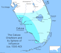 Calusa-Chiefdom-Map.svg 1,600 × 1,400; 2.07 MB
-
 Cessions Southeastern Tribes- Andrew Jackson.jpg 2,030 × 1,512; 1.91 MB
-
 Chesapeake Bay Watershed.png 300 × 345; 16 KB
-
 Chinook.png 1,497 × 1,101; 2.43 MB
-
 Chééwokii bikeyah 1771.svg 1,018 × 570; 73 KB
-
 Cimarrones und Reiterkulturen in Südamerika.png 403 × 671; 147 KB
-
 Coeur d'Alene Tribe.jpg 640 × 500; 74 KB
-
 Crawford expedition.PNG 660 × 495; 121 KB
-
 De Smet map of the 1851 Fort Laramie Indian territories (the light area). PNG.png 4,255 × 2,849; 20.73 MB
-
 Early atlanta indian trails.jpg 526 × 731; 69 KB
-
 Early Indian territories in Montana by treaty.png 992 × 556; 252 KB
-
 Early Indian treaty territories, North Dakota - an overview map.png 1,279 × 830; 418 KB
-
 Early Indian treaty territories, North Dakota. Map 1 (1851-1891).png 1,440 × 845; 2.85 MB
-
 Early Indian treaty territories, North Dakota. Map and overview.png 1,278 × 1,675; 2.99 MB
-
 Early Indians-pueblos.jpg 540 × 441; 152 KB
-
 Early Localization Native Americans NY - Red-Green Coloring.svg 936 × 766; 291 KB
-
 Early Localization Native Americans NY.svg 936 × 768; 291 KB
-
 Early-Indian-NE,Montreal+Huronen.JPG 1,360 × 850; 291 KB
-
 Eastern agricultural complex.png 495 × 500; 901 KB
-
 Els Micmac.png 2,360 × 1,650; 985 KB
-
 Erie-Territorium um 1630.png 1,200 × 902; 1.37 MB
-
 Expansion Karibe.JPG 554 × 498; 68 KB
-
 Eyak lang.png 1,026 × 1,299; 303 KB
-
 Federally recognized tribes by state.png 3,996 × 2,471; 361 KB
-
 First Nations lands of New Brunswick map-blank.svg 2,237 × 2,199; 647 KB
-
 Flathead01.png 1,338 × 1,045; 2.16 MB
-
 FLMap-Ais tribe.PNG 300 × 295; 8 KB
-
 FLMap-Mayaimi.PNG 300 × 295; 8 KB
-
 FLMap-Tequesta-tribe2.PNG 300 × 295; 9 KB
-
 FondDuLac.jpg 1,650 × 1,650; 359 KB
-

-
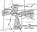 Foun indian campaigns.jpg 776 × 679; 69 KB
-
 Fremont culture region.svg 695 × 801; 227 KB
-
 Georgia, from the latest authorities. LOC 2010587363.jpg 4,536 × 5,105; 3.57 MB
-
 Goshute rez map.svg 512 × 423; 576 KB
-
 Grosventre01.png 1,343 × 1,248; 2.41 MB
-
 Guaicuras.png 687 × 901; 791 KB
-
 Gwawaenuk.png 1,814 × 1,196; 4.08 MB
-
 Wohngebiet Havasupai.png 755 × 1,150; 1.34 MB
-
-

-
-

-
 Oasisamérica-Hohokam.png 766 × 965; 1.19 MB
-
 Hualapai havasupai res.png 506 × 486; 383 KB
-
 Hän lang.jpg 1,280 × 1,621; 351 KB
-
 I Mi'kmaq.png 2,360 × 1,650; 1,002 KB
-
 Illinois 1.jpg 2,776 × 3,992; 2.8 MB
-
 Illinois02.png 1,366 × 1,140; 2.3 MB
-
 Indian territories, North Dakota. Map 2 (1875-1889).png 1,431 × 852; 2.61 MB
-
 Indian territories, North Dakota. Map 3 (1880-1892).png 1,437 × 847; 2.64 MB
-
 Indiana Indian treaties.jpg 334 × 550; 161 KB
-
 Indiana Indian treaties.svg 2,887 × 4,423; 313 KB
-
 IndianTerritory.jpg 1,000 × 1,061; 233 KB
-
 IndianTerritory1885.jpg 1,321 × 1,000; 413 KB
-
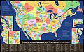 Indigenous American Nations, 16th century - 2022 edition.jpg 17,280 × 10,800; 24.71 MB
-
 Indigenous people of Everglades map.jpg 2,197 × 2,249; 479 KB
-
 Indigenous-Peoples-Of-Florida-Map.png 5,770 × 5,000; 1.12 MB
-
 Innus.png 450 × 483; 19 KB
-
 Iowa cessions map.png 3,009 × 2,254; 10.67 MB
-
 IsleRoyaleAgreement.jpg 1,100 × 800; 567 KB
-
 Juaneño map.svg 512 × 454; 14 KB
-
 Kansa (Kaw) cessions and reservations, 1825-1873.png 2,077 × 1,321; 4.14 MB
-
 Kansaspacificgrants.jpg 5,304 × 3,497; 2.71 MB
-
 Karte-Prärie-Indianer-Pferd-und-Bison.png 733 × 962; 473 KB
-
 Katzie.png 1,814 × 1,196; 4.28 MB
-
 Kickapoo01.png 1,366 × 1,140; 2.32 MB
-
 Kiowa map.jpg 615 × 453; 102 KB
-
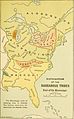
 Kroeber-1923-Cultural-Area.jpg 1,452 × 2,355; 467 KB
-
 KroeberMap-Color.jpg 1,384 × 2,273; 971 KB
-
 La vallée de l'Ohio et ses forts en 1755.jpg 1,438 × 959; 638 KB
-
 Lac Court Oreilles Indian Reservation - NARA - 84786000.jpg 11,444 × 9,267; 4.69 MB
-
 Lake Pepin Half-Breed.png 955 × 666; 1.31 MB
-

-
 Lebensraum der Spokane Indianer.png 1,256 × 1,058; 2.09 MB
-
 Lee County Half-Breed.png 640 × 462; 481 KB
-
 Les Micmacs (multilingual).svg 3,387 × 2,113; 455 KB
-
 Les Micmacs.png 2,360 × 1,650; 1,007 KB
-
 Longisland.png 1,276 × 811; 524 KB
-
 Longisland1.png 1,276 × 811; 523 KB
-
 Los Micmac.png 2,360 × 1,650; 996 KB
-
 Mamalilikulla.png 1,814 × 1,196; 3.65 MB
-
 Map albert gallatin 1836.jpg 1,600 × 901; 464 KB
-
 Map Anasazi, Hohokam and Mogollon cultures-en.svg 912 × 1,122; 71 KB
-
 Map Anasazi, Hohokam and Mogollon cultures-es.svg 912 × 1,122; 76 KB
-
 Map Anasazi, Hohokam and Mogollon cultures-fr.svg 912 × 1,122; 76 KB
-
 Map Anasazi, Hohokam and Mogollon cultures-nl.svg 912 × 1,122; 69 KB
-
-
 Map from "Letters and notes on the manners..." Vol II Wellcome L0073493.jpg 3,471 × 5,400; 4.98 MB
-
 Map of Anishinaabe Aki. including NAN.jpg 552 × 340; 220 KB
-
 Map of Greer County Texas.png 1,321 × 1,000; 1.64 MB
-

-
 Map of Indians Texas 1500.png 2,308 × 1,584; 521 KB
-
 Map of Makah Territory (c.1855-2023).png 1,959 × 1,865; 54 KB
-
 Map of territorial growth 1775-es.svg 506 × 662; 229 KB
-
 Map of territorial growth 1775-zh.svg 632 × 827; 243 KB
-
 Map of territorial growth 1775.jpg 570 × 750; 172 KB
-
-
 Map of the Greater Ameridia Patria.png 1,318 × 804; 171 KB
-

-
 Map of the Jesuit missions in Huronia (1908?).jpg 2,031 × 1,473; 488 KB
-
 Map of the Oregon Territory by the U. S. Ex. Ex.png 7,000 × 4,843; 62 MB
-
 Map of the United States showing lines of treaties - NARA - 139309115 (page 1).jpg 10,200 × 4,463; 3.05 MB
-
 Map of the United States showing lines of treaties - NARA - 139309115 (page 2).jpg 10,592 × 5,356; 3.26 MB
-
 Map showing distribution of Indian stocks and tribes, between 1710-1720 (7557417074).jpg 4,045 × 6,991; 30.12 MB
-
 Map with Indian territories in Montana.png 1,973 × 1,173; 5.4 MB
-
 Map with the route of a Crow Indian camp and Francois-Antoine Larocque in 1805.png 1,716 × 1,045; 952 KB
-
 Mapa embera dispersion dialectos.jpg 4,361 × 6,068; 1.93 MB
-
 Mapa Terytorium Indiańskiego w XIX wieku.png 427 × 585; 64 KB
-
 Mascouten01.png 1,366 × 1,140; 2.31 MB
-
 Mason-dixon-line-HE.png 438 × 291; 11 KB
-
-
 McConnell's historical map, Indian Tribes.jpg 3,302 × 2,389; 1.35 MB
-
 Menominee01.png 1,366 × 1,140; 2.32 MB
-
 Migration Map.jpg 560 × 345; 117 KB
-
 Mikmaq-Stammesgebiet.png 2,360 × 1,650; 1,001 KB
-
 Mississauga01.png 1,366 × 1,140; 2.31 MB
-
 Missouri tribal area.png 1,366 × 1,140; 2.26 MB
-
 Mobile in 1732.jpg 592 × 996; 612 KB
-
 Mocama-People-Map.png 2,571 × 1,699; 204 KB
-
 Mohican distribution map.svg 1,121 × 1,277; 696 KB
-
 Moultriecreekreservation.PNG 300 × 295; 9 KB
-
 Mowachaht-Muchalaht.png 1,757 × 1,196; 4.14 MB
-
 Nanfan-es.svg 512 × 396; 1.86 MB
-
 Nanfan.jpg 994 × 768; 543 KB
-
 Nanfan.svg 512 × 396; 1.48 MB
-
 National Atlas.gif 589 × 450; 63 KB
-
 National-atlas-indian-reservations-south-dakota.gif 764 × 584; 84 KB
-
 Native American Territories, SE section, North America, 1715.png 967 × 655; 135 KB
-
 Native Tribes 1783.jpg 392 × 381; 35 KB


%27_(11161630183).jpg)
.jpg)


_-_Geographicus_-_CarolinaGeorgia-bowen-1747.jpg)

%27_(11019472894).jpg)


_-_Geographicus_-_UnitedStates-burr-1839.jpg)


_Ethnographische_Karte,_das_Gebiet_der_TLINKIT.jpg)
%27_(11010012073).jpg)
%27_(11129666724).jpg)
%27_(11226516215).jpg)


.jpg)
_(14779003632).jpg)


_(18402278616).jpg)
_(18739040564).jpg)
_(19173685358).jpg)


.png)
.jpg)
.jpg)
.jpg)


.png)


.png)

_(14577902110).jpg)

.png)


_(20397569146).jpg)
_(20415174642).jpg)
_(19803395283).jpg)
_(19803730223).jpg)
_(20238043849).jpg)


._PNG.png)


.png)


.jpg)
.jpg)
_(14578173667).jpg)
_(14759859956).jpg)


.png)
.png)


_cessions_and_reservations,_1825-1873.png)


.jpg)


.svg)


_-_NARA_-_102278691_(page_3).jpg)


.jpg)

.png)


.jpg)

.jpg)
.jpg)
.jpg)


,_Nebraska._Pawnee_reservation_and_relevant_Indian_territories.png)


