Category:Maps of North West municipalities with 2016 borders
Jump to navigation
Jump to search
This category contains maps of municipalities in the North West province of South Africa that show the the municipal borders as they are after the municipal election of 3 August 2016. This is the most recent demarcation.
Media in category "Maps of North West municipalities with 2016 borders"
The following 31 files are in this category, out of 31 total.
-
 Map of the North West with districts labelled (2016).svg 912 × 630; 488 KB
-
 Map of the North West with municipalities blank (2016).svg 912 × 630; 761 KB
-
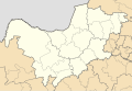
 Blank map of the North West (2016).svg 838 × 596; 389 KB
-
 Map of South Africa with Bojanala Platinum highlighted (2016).svg 809 × 709; 703 KB
-
 Map of the North West with Bojanala Platinum highlighted (2016).svg 912 × 630; 424 KB
-
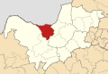
 Map of the North West with Ditsobotla highlighted (2016).svg 912 × 630; 414 KB
-
 Map of South Africa with Dr Kenneth Kaunda highlighted (2016).svg 809 × 709; 708 KB
-
 Map of the North West with Dr Kenneth Kaunda highlighted (2016).svg 912 × 630; 440 KB
-

-

-
 Map of the North West with Greater Taung highlighted (2016).svg 912 × 630; 417 KB
-
 Map of the North West with Kagisano-Molopo highlighted (2016).svg 912 × 630; 436 KB
-
 Map of the North West with Kgetlengrivier highlighted (2016).svg 912 × 630; 410 KB
-
 Map of the North West with Lekwa-Teemane highlighted (2016).svg 912 × 630; 417 KB
-
 Map of the North West with Madibeng highlighted (2016).svg 912 × 630; 418 KB
-
 Map of the North West with Mahikeng highlighted (2016).svg 912 × 630; 416 KB
-
 Map of the North West with Mamusa highlighted (2016).svg 912 × 630; 414 KB
-

-

-
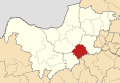
 Map of the North West with Maquassi Hills highlighted (2016).svg 912 × 630; 420 KB
-
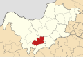
 Map of the North West with Matlosana highlighted (2016).svg 912 × 630; 414 KB
-
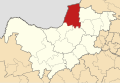
 Map of the North West with Moretele highlighted (2016).svg 912 × 630; 410 KB
-
 Map of the North West with Moses Kotane highlighted (2016).svg 912 × 630; 416 KB
-
 Map of the North West with Naledi highlighted (2016).svg 912 × 630; 418 KB
-
 Map of South Africa with Ngaka Modiri Molema highlighted (2016).svg 809 × 709; 707 KB
-
 Map of the North West with Ngaka Modiri Molema highlighted (2016).svg 912 × 630; 434 KB
-
 Map of the North West with Ramotshere Moiloa highlighted (2016).svg 912 × 630; 418 KB
-
 Map of the North West with Ratlou highlighted (2016).svg 912 × 630; 419 KB
-
 Map of the North West with Rustenburg highlighted (2016).svg 912 × 630; 414 KB
-
 Map of the North West with Tswaing highlighted (2016).svg 912 × 630; 414 KB
-
 Map of the North West with Ventersdorp-Tlokwe highlighted (2016).svg 912 × 630; 421 KB
.svg)
.svg)
.svg)
.svg)
.svg)
.svg)
.svg)
.svg)
.svg)
.svg)
.svg)
.svg)
.svg)
.svg)
.svg)
.svg)
.svg)
.svg)
.svg)
.svg)
.svg)
.svg)
.svg)
.svg)
.svg)
.svg)
.svg)
.svg)
.svg)
.svg)
.svg)