Category:Maps of Okinawa Island
Jump to navigation
Jump to search
English: Category for maps of Okinawa Island in Okinawa Prefecture, Japan
日本語: 沖縄県・沖縄本島の地図に関するカテゴリ
Wikimedia category | |||||
| Upload media | |||||
| Instance of | |||||
|---|---|---|---|---|---|
| Category combines topics | |||||
| Okinawa | |||||
smallest of the five main islands of Japan    | |||||
| Instance of | |||||
| Location | Okinawa Prefecture, Japan | ||||
| Located in or next to body of water | |||||
| Connects with | |||||
| Present in work |
| ||||
| Has part(s) |
| ||||
| Width |
| ||||
| Length |
| ||||
| Highest point |
| ||||
| Population |
| ||||
| Area |
| ||||
 | |||||
Subcategories
This category has the following 2 subcategories, out of 2 total.
M
- Maps of Okinawa on stamps (1 F)
U
Media in category "Maps of Okinawa Island"
The following 30 files are in this category, out of 30 total.
-
 Administrative divisions in Okinawa Island.png 558 × 680; 41 KB
-
 Awase map1.png 475 × 458; 22 KB
-
 Battlefield Composite Map of Okinawa.jpg 23,952 × 46,337; 255.53 MB
-
 Hokuzan.jpg 561 × 616; 89 KB
-
 Map of Motobu Peninsula.png 3,712 × 2,520; 1.16 MB
-
 Map of Okinawa Island 02.svg 750 × 1,000; 292 KB
-
 Map of Okinawa Island.svg 400 × 500; 23 KB
-
 Map of Western Okinawa Beaches - NARA - 100307410.jpg 10,272 × 13,283; 6.98 MB
-
 Map of Yambaru National Park.svg 750 × 1,000; 434 KB
-
 Middle Region of Okinawa Island.gif 558 × 680; 29 KB
-
 Napakiang Roads - Great Loo Choo Island.jpg 1,200 × 933; 116 KB
-
 North Region of Okinawa Island.gif 558 × 680; 28 KB
-
 Okinawa Expressway map.jpg 547 × 674; 125 KB
-
 Okinawa Jima.jpg 571 × 730; 83 KB
-
 OKINAWA UDT-7 MAP Yellow Beaches.jpg 2,625 × 2,000; 745 KB
-
 OkinawaUSBasesMap.jpg 710 × 903; 320 KB
-
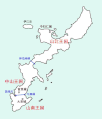
 Route330 Route449 Route505 ja.png 500 × 581; 33 KB
-
 Ryukyu Invasion Phase5.png 1,117 × 1,345; 940 KB
-
 Ryukyu Invasion Phase6.png 1,117 × 1,345; 937 KB
-
 Ryukyu Invasion Phase7.png 1,117 × 1,345; 940 KB
-
 Ryukyu Invasion Phase8.png 1,117 × 1,345; 937 KB
-
 Ryukyu Kingdoms of Sanzan era.jpg 1,165 × 1,476; 102 KB
-
 Ryukyumap.gif 600 × 702; 63 KB
-
 Simplified Geological Map of northern Okinawa Island.png 524 × 476; 976 KB
-
 South Region of Okinawa Island.gif 558 × 680; 29 KB
-
 Topographic map of Okinawa Island for location map.png 750 × 1,000; 552 KB
-
 Topographic map of Okinawa Island.png 1,117 × 1,345; 1.04 MB
-
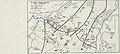 XXXIV Corps Advance Checked - NARA - 100307408.jpg 14,240 × 6,421; 3.64 MB
-
 国頭方西海道経路図.jpg 1,344 × 1,008; 153 KB
-
 沖縄本島北部地域にある文学碑.png 1,996 × 1,556; 1.83 MB


