Category:Maps of Orihuela
Jump to navigation
Jump to search
Wikimedia category | |||||
| Upload media | |||||
| Instance of | |||||
|---|---|---|---|---|---|
| Category combines topics | |||||
| Orihuela | |||||
municipality of Spain .JPG) Edifici de l'Ajuntament amb l'Església de les Santes Justa i Rufina darrere. .png)   | |||||
| Instance of | |||||
| Patron saint |
| ||||
| Location | Vega Baja del Segura, province of Alicante, Valencian Community, Spain | ||||
| Located in or next to body of water | |||||
| Capital |
| ||||
| Official language | |||||
| Head of government |
| ||||
| Population |
| ||||
| Area |
| ||||
| Elevation above sea level |
| ||||
| official website | |||||
 | |||||
Media in category "Maps of Orihuela"
The following 15 files are in this category, out of 15 total.
-
 Localització d'Oriola respecte al País Valencià.png 238 × 400; 28 KB
-
 Localització d'Oriola respecte el Baix Segura.png 595 × 595; 57 KB
-
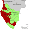
 Localización de Pedanías de Orihuela.png 348 × 540; 56 KB
-
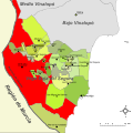 Orihuela-Mapa de la Vega Baja del Segura.svg 595 × 595; 378 KB
-
 Karte Gemeinde Orihuela 2022.png 5,000 × 5,185; 1.85 MB
-
 Mapa del lugar de Molins. Archivo del Reino de Valencia.jpg 5,264 × 3,948; 3.47 MB
-
 Mapa del municipio de Orihuela.gif 744 × 701; 109 KB
-
 MTN25-0913c2-1980-Orihuela.jpg 7,726 × 5,377; 6.9 MB
-
 MTN25-0913c2-2002-Orihuela.jpg 7,726 × 5,434; 10.06 MB
-
 MTN25-0914c1-1976-Guardamar del Segura-I (Almoradi).jpg 7,726 × 5,415; 7.08 MB
-
 MTN25-0914c1-2001-Almoradi.jpg 7,726 × 5,443; 9.65 MB
-
 MTN25-0914c1-2012-Almoradi.jpg 7,874 × 5,165; 11.88 MB
-
 Orihuela-Plano con Pedanías.svg 348 × 540; 1.79 MB
-
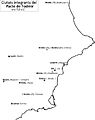 Pacte de Todmir.jpg 3,733 × 4,698; 709 KB
-
 Pacto de Teodomiro.JPG 3,733 × 4,698; 613 KB


.jpg)


