Category:Maps of Paris in the 1940s
Jump to navigation
Jump to search
Media in category "Maps of Paris in the 1940s"
The following 13 files are in this category, out of 13 total.
-
 Population density of Paris, 1946 - Demographia.svg 512 × 293; 185 KB
-
 Blondel la Rougery, Plan Blondel Paris et banlieue, 1944 - Gallica.jpg 11,868 × 8,418; 18.5 MB
-

-
 Carte guide des bons coins de pêche de l'Ile-de-France, 1948 (verso) - Gallica.jpg 8,806 × 6,370; 7.13 MB
-
 Carte guide des bons coins de pêche de l'Ile-de-France, 1948 - Gallica.jpg 8,806 × 6,370; 8.48 MB
-
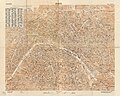
 Girard et Barrère, Paris, 1945 - Gallica.jpg 10,340 × 7,454; 16.3 MB
-
 Industrie Paris Sudost Blatt, 1940 - Mapster.jpg 16,143 × 11,448; 24.51 MB
-
 Services d'architecture et d'urbanisme, Ville de Paris. Plan des servitudes, 1948 - Gallica.jpg 11,048 × 8,760; 15.91 MB
-
 U.S. Army Map Service, Paris 1944 - Mapster.jpg 16,000 × 13,655; 38.6 MB
-
 U.S. Army Map Service, Paris 1944 - The University of Texas at Austin.jpg 6,560 × 5,242; 15.53 MB
-
 War Office (Great Britain) - Paris, 1944 - McMaster University.jpg 23,018 × 16,782; 222.47 MB
-
 War Office (Great Britain) - Paris, Fontainebleau, 1944 (Paris) - McMaster University.jpg 15,050 × 9,060; 67.68 MB
-
 War Office (Great Britain) - Paris, Fontainebleau, 1944 - McMaster University.jpg 18,756 × 21,520; 177.74 MB


_-_Gallica.jpg)


_-_Paris,_1944_-_McMaster_University.jpg)
_-_Paris,_Fontainebleau,_1944_(Paris)_-_McMaster_University.jpg)
_-_Paris,_Fontainebleau,_1944_-_McMaster_University.jpg)