Category:Maps of Portet-sur-Garonne
Jump to navigation
Jump to search
Wikimedia category | |||||
| Upload media | |||||
| Instance of | |||||
|---|---|---|---|---|---|
| Category combines topics | |||||
| Portet-sur-Garonne | |||||
commune in Haute-Garonne, France  .svg)  | |||||
| Instance of | |||||
| Named after | |||||
| Location |
| ||||
| Located in or next to body of water | |||||
| Population |
| ||||
| Area |
| ||||
| Elevation above sea level |
| ||||
| official website | |||||
 | |||||
Media in category "Maps of Portet-sur-Garonne"
The following 8 files are in this category, out of 8 total.
-
 31433-Portet-sur-Garonne-argile.jpg 3,057 × 2,480; 774 KB
-
 31433-Portet-sur-Garonne-Natura2000.png 7,015 × 4,960; 15.64 MB
-
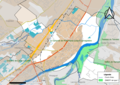
 31433-Portet-sur-Garonne-Routes-Hydro.png 3,507 × 2,480; 5.34 MB
-
 31433-Portet-sur-Garonne-Sols.png 7,015 × 4,960; 13.34 MB
-
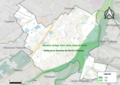
 31433-Portet-sur-Garonne-ZNIEFF1.png 3,519 × 2,480; 3.04 MB
-
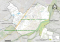 31433-Portet-sur-Garonne-ZNIEFF2.png 3,519 × 2,480; 6.87 MB
-
 Map commune FR insee code 31433.png 756 × 605; 83 KB
-
 ZNIEFF du vallon de Ramade.png 2,843 × 1,404; 1.74 MB


