Category:Maps of Saint-Maurice-sur-Aveyron
Jump to navigation
Jump to search
Wikimedia category | |||||
| Upload media | |||||
| Instance of | |||||
|---|---|---|---|---|---|
| Category combines topics | |||||
| Saint-Maurice-sur-Aveyron | |||||
commune in Loiret, France  .svg)  | |||||
| Instance of | |||||
| Named after | |||||
| Location |
| ||||
| Population |
| ||||
| Area |
| ||||
| official website | |||||
 | |||||
Subcategories
This category has only the following subcategory.
Media in category "Maps of Saint-Maurice-sur-Aveyron"
The following 9 files are in this category, out of 9 total.
-
 45 Znieff 282.jpg 5,457 × 3,543; 1.01 MB
-
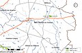
 45-Saint-Maurice-sur-Aveyron-Routes.png 5,457 × 3,543; 1.71 MB
-
 45292-Saint-Maurice-sur-Aveyron-argile.png 3,057 × 2,480; 2.87 MB
-
 45292-Saint-Maurice-sur-Aveyron-Cours eau.jpg 3,507 × 2,480; 552 KB
-
 45292-Saint-Maurice-sur-Aveyron-Hydro.jpeg 5,846 × 4,133; 2.27 MB
-
 45292-Saint-Maurice-sur-Aveyron-Orthophoto.jpeg 10,559 × 7,440; 10.46 MB
-
 45292-Saint-Maurice-sur-Aveyron-Sols.png 3,519 × 2,480; 2.22 MB
-
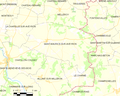 Map commune FR insee code 45292.png 756 × 605; 68 KB
-
 Saint-Maurice-sur-Aveyron-Interco.png 3,507 × 2,480; 1.4 MB


