Category:Maps of Sawyer County, Wisconsin
Jump to navigation
Jump to search
Counties of Wisconsin: Adams · Ashland · Barron · Bayfield · Brown · Buffalo · Burnett · Calumet · Chippewa · Clark · Columbia · Crawford · Dane · Dodge · Door · Douglas · Dunn · Eau Claire · Florence · Fond du Lac · Forest · Grant · Green · Green Lake · Iowa · Iron · Jackson · Jefferson · Juneau · Kenosha · Kewaunee · La Crosse · Lafayette · Langlade · Lincoln · Manitowoc · Marathon · Marinette · Marquette · Menominee · Milwaukee · Monroe · Oconto · Oneida · Outagamie · Ozaukee · Pepin · Pierce · Polk · Portage · Price · Racine · Richland · Rock · Rusk · Sauk · Sawyer · Shawano · Sheboygan · St. Croix · Taylor · Trempealeau · Vernon · Vilas · Walworth · Washburn · Washington · Waukesha · Waupaca · Waushara · Winnebago · Wood
| NO WIKIDATA ID FOUND! Search for Maps of Sawyer County, Wisconsin on Wikidata | |
| Upload media |
Media in category "Maps of Sawyer County, Wisconsin"
The following 5 files are in this category, out of 5 total.
-
 Map of Wisconsin highlighting Sawyer County.svg 4,747 × 5,087; 103 KB
-
 NPS namekagon-river-map-1-namekagon-dam.jpg 2,025 × 1,560; 504 KB
-
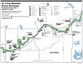 NPS namekagon-river-map-2-hayward-landing.jpg 2,032 × 1,572; 435 KB
-

-
 WI 7th Congressional District.png 640 × 390; 77 KB


