Category:Maps of Sevran
Jump to navigation
Jump to search
Arrondissement of Bobigny: Bagnolet · Bobigny · Bondy · Les Lilas · Montreuil · Noisy-le-Sec · Pantin · Le Pré-Saint-Gervais · Romainville ·
Arrondissement of Saint-Denis, Seine-Saint-Denis: Aubervilliers · La Courneuve · Épinay-sur-Seine · L'Île-Saint-Denis · Pierrefitte-sur-Seine · Saint-Denis · Saint-Ouen-sur-Seine · Stains · Villetaneuse ·
Arrondissement of Le Raincy: Aulnay-sous-Bois · Le Blanc-Mesnil · Le Bourget · Clichy-sous-Bois · Coubron · Drancy · Dugny · Gagny · Gournay-sur-Marne · Livry-Gargan · Montfermeil · Neuilly-Plaisance · Neuilly-sur-Marne · Noisy-le-Grand · Les Pavillons-sous-Bois · Le Raincy · Rosny-sous-Bois · Sevran · Tremblay-en-France · Vaujours · Villemomble · Villepinte ·
Wikimedia category | |||||
| Upload media | |||||
| Instance of | |||||
|---|---|---|---|---|---|
| Category combines topics | |||||
| Sevran | |||||
French commune in Seine-Saint-Denis, Île-de-France     | |||||
| Pronunciation audio | |||||
| Instance of | |||||
| Location | |||||
| Head of government |
| ||||
| Population |
| ||||
| Area |
| ||||
| Elevation above sea level |
| ||||
| official website | |||||
 | |||||
Media in category "Maps of Sevran"
The following 12 files are in this category, out of 12 total.
-
 93071-Sevran-Hydro.jpeg 5,846 × 4,133; 4.19 MB
-
 93071-Sevran-Sols.png 3,270 × 2,598; 7.2 MB
-
 Carte des Chasses du Roi.1800.Sevran.jpg 1,077 × 589; 282 KB
-
 Carte Quartiers Sevran.svg 769 × 633; 124 KB
-
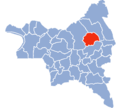 Carte Seine-Saint-Denis Sevran.png 611 × 552; 20 KB
-
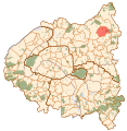
 Map commune FR insee code 93071.png 756 × 605; 53 KB
-

-
 Sevran carte de Cassini1.jpg 419 × 306; 146 KB
-
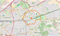 Sevran Limite communale (OSM).jpg 961 × 577; 249 KB
-
 Sevran map.svg 1,552 × 1,586; 540 KB
-
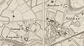
 Sevran-Carte de France dite d Etat-Major.jpg 987 × 583; 789 KB
-
 Sevran.Carte de Delagrive.1740.Place Gaston-Bussière.IGN.Geoportail.jpg 743 × 584; 174 KB


_dans_son_EPT_de_Paris_Terre_d%27Envol_au_sein_de_la_M%C3%A9tropole_du_Grand_Paris.png)

.jpg)

