Category:Maps of Spandau citadel
Jump to navigation
Jump to search
Media in category "Maps of Spandau citadel"
The following 8 files are in this category, out of 8 total.
-
 Faulhaber Haubt-Vöstung Spandaw 1680 (lres).jpg 466 × 537; 108 KB
-
 Faulhaber Haubt-Vöstung Spandaw 1680.jpg 2,047 × 1,800; 1.2 MB
-
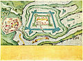
 Lynarplan Zitadelle Spandau 1578.jpg 6,170 × 5,524; 13.95 MB
-
 M. Dögen, Spandow, 1647.jpg 4,600 × 3,404; 4.82 MB
-
 Plan de Spandau 1751-1770.jpg 1,499 × 1,170; 476 KB
-
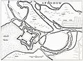
 Situations Plan von der Stadt und Festung Spandow 1812.jpg 3,589 × 2,161; 2.78 MB
-
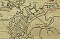 Spandau um 1812.jpg 1,288 × 842; 656 KB
-
 Stadt, Schloß und Vöstung Spandaw 1604.jpg 5,820 × 4,257; 11.03 MB
.jpg)


