Category:Maps of Tarnowskie Góry
Jump to navigation
Jump to search
Wikimedia category | |||||
| Upload media | |||||
| Instance of | |||||
|---|---|---|---|---|---|
| Category combines topics | |||||
| Tarnowskie Góry | |||||
town in the Silesian Voivodeship in southern Poland   .svg)  | |||||
| Instance of |
| ||||
| Location | Tarnowskie Góry county, Silesian Voivodeship, Poland | ||||
| Head of government |
| ||||
| Population |
| ||||
| Area |
| ||||
| Elevation above sea level |
| ||||
| Different from | |||||
| official website | |||||
 | |||||
Media in category "Maps of Tarnowskie Góry"
The following 33 files are in this category, out of 33 total.
-
 Alt Tarnowitz.jpg 1,091 × 539; 423 KB
-

-
 Bobrownik (Königl.Preuss.Landes-Aufnahme 1881).jpg 1,165 × 491; 193 KB
-
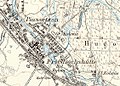
 Friedrichshütte OS.jpg 589 × 586; 131 KB
-

-
 Kgl.Friedrichsgrube - Bleiwäsche.jpg 1,279 × 871; 321 KB
-
 Kol.Lassowitz, Paulsborn, Zgl.jpg 784 × 531; 251 KB
-
 Mapatarnowskie.jpg 350 × 324; 18 KB
-
 P47-S27-C STRZYBNICA 1933 WIG.jpg 1,181 × 839; 592 KB
-
 P47-S27-C STRZYBNICA 1933 WIG2.jpg 1,181 × 839; 593 KB
-
 Piassetzna.jpg 1,124 × 808; 720 KB
-
 Powiat tarnogórski - Tarnowskie Góry.svg 310 × 247; 16 KB
-
 PrincipatusSilesiaeOppoliensis1736 - Tarnowitz.jpg 640 × 438; 352 KB
-
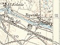 Repetzko.jpg 1,261 × 946; 962 KB
-
 Sowitz u. Gruschkamühle.jpg 1,273 × 881; 586 KB
-
 Tarn. Góry - ulica - Wincentego Janasa.JPG 421 × 600; 28 KB
-
 Tarnowitz - Verkehrsplan (Bismarckstr., Moltkestr., Strasse der S.A. usw.).jpg 1,321 × 991; 1.57 MB
-
 Tarnowitz - Verkehrsplan.jpg 11,001 × 8,372; 13.36 MB
-
 Tarnowitz Evgl. Kirchh. Karte.jpg 1,187 × 737; 475 KB
-
 Tarnowskie Gory map.png 497 × 468; 27 KB
-
 Tarnowskie Góry (mapa administracyjna z nazwami dzielnic).png 968 × 1,378; 134 KB
-
 Tarnowskie Góry (mapa administracyjna).svg 968 × 1,379; 74 KB
-
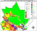
 Tarnowskie Góry - MPZP północnych dzielnic miasta (Tłuczykąt).jpg 965 × 1,327; 345 KB
-
 Tarnowskie Góry - MPZP północnych dzielnic miasta.jpg 9,037 × 7,589; 13.99 MB
-
 Tarnowskie Góry - ulica - Bytomska.JPG 421 × 600; 28 KB
-
 Tarnowskie Góry - ulica - Jana III Sobieskiego.jpg 421 × 600; 28 KB
-
 Tarnowskie Góry - ulica - Józefa Korola.JPG 421 × 600; 28 KB
-
 Tarnowskie Góry - ulica - Krakowska.JPG 421 × 600; 28 KB
-
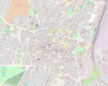 Tarnowskie Góry downtown location map.png 1,850 × 1,463; 1.8 MB
-
 Tarnowskie Góry location map.png 1,663 × 2,368; 2.78 MB
-
 Tarnowskie Góry old town location map.png 915 × 870; 590 KB
-
 Tarnowskie Góry Subdivisions.svg 1,590 × 2,112; 482 KB
-
 Wernher Standesherrschaft Beuthen map.tif 1,172 × 1,372; 4.61 MB

.jpg)
.jpg)


.jpg)


.png)
.svg)
.jpg)


