Category:Maps of Utiel
Jump to navigation
Jump to search
Media in category "Maps of Utiel"
The following 9 files are in this category, out of 9 total.
-
 Baeza Utiel ferrocarril.png 4,192 × 3,528; 8.12 MB
-
 Karte Gemeinde Utiel 2022.png 5,000 × 5,980; 2.61 MB
-
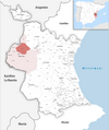
 Localització d'Utiel respecte de la Plana d'Utiel.png 400 × 400; 35 KB
-
 Localització d'Utiel respecte del País Valencià.png 238 × 400; 26 KB
-
 MTN25-0693c2-1996-Las Cuevas.jpg 7,726 × 5,412; 6.12 MB
-
 MTN25-0693c2-2003-Las Cuevas.jpg 7,726 × 5,412; 10.04 MB
-
 MTN25-0693c4-1996-Utiel.jpg 7,726 × 5,412; 6.24 MB
-
 MTN25-0693c4-2003-Utiel.jpg 7,726 × 5,412; 9.51 MB
-
 MTN25-0694c1-2008-Villar de Tejas.jpg 7,874 × 5,168; 11.01 MB


