Category:Maps of Wiesbaden
Jump to navigation
Jump to search
Districts of Hesse:
Urban districts (cities):
Wikimedia category | |||||
| Upload media | |||||
| Instance of | |||||
|---|---|---|---|---|---|
| Category combines topics | |||||
| Wiesbaden | |||||
capital of the German state of Hesse       | |||||
| Instance of |
| ||||
| Part of | |||||
| Location |
| ||||
| Located in or next to body of water | |||||
| Head of government |
| ||||
| Highest point | |||||
| Population |
| ||||
| Area |
| ||||
| Elevation above sea level |
| ||||
| official website | |||||
 | |||||
Subcategories
This category has the following 5 subcategories, out of 5 total.
E
- Election maps of Wiesbaden (2 F)
L
O
- Old maps of Wiesbaden (36 F)
- OpenStreetMap maps of Wiesbaden (16 F)
P
Pages in category "Maps of Wiesbaden"
This category contains only the following page.
Media in category "Maps of Wiesbaden"
The following 19 files are in this category, out of 19 total.
-
 Berliner Strasse, Wiesbaden (Duggan).jpg 2,081 × 1,157; 728 KB
-
 Brockhaus b16 nr0718a hfid 5183759.jpg 2,667 × 3,474; 2.85 MB
-
 Hessen WI.png 722 × 957; 92 KB
-
 Karte - Herzogtum Nassau - 46. Wiesbaden - 1819 (cropped).jpg 1,104 × 733; 512 KB
-
 Karte - Herzogtum Nassau - 47. Eltville - 1819 (cropped, Eiserne Hand).jpg 1,817 × 1,416; 1.62 MB
-
 Karte - Herzogtum Nassau - 47. Eltville - 1819 - Frauenstein.jpg 1,442 × 861; 2 MB
-
 Karte - Herzogtum Nassau - 47. Eltville - 1819.jpg 3,969 × 5,557; 9.49 MB
-
 Karte Umfahrung der Schiersteiner Brücke.png 1,480 × 1,996; 328 KB
-
 Karte Wiesbaden in Deutschland.png 188 × 235; 3 KB
-
 Lage des Kriegerdenkmals.jpg 642 × 516; 75 KB
-
 Lindsey Air Station Color.jpg 1,260 × 1,135; 357 KB
-
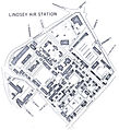 Lindsey Air Station map.jpg 1,497 × 1,641; 707 KB
-
 Locator map WI in Hesse.svg 868 × 1,164; 655 KB
-
 NordfriedhofWiesbadenPlan.JPG 512 × 556; 47 KB
-
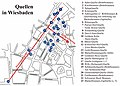 Quellen fg02.jpg 800 × 573; 318 KB
-
 SüdfriedhofPlan.JPG 491 × 506; 47 KB
-
 Wiesbaden in Germany.png 188 × 235; 5 KB
-
 Wiesbaden Merian.png 2,000 × 1,413; 2.13 MB
-
 Wiesbaden subdivisions (colored scheme).svg 1,126 × 1,014; 1.45 MB
.jpg)


.jpg)
.jpg)


.svg)