Category:Maps of Yavapai County, Arizona
Jump to navigation
Jump to search
Wikimedia category | |||||
| Upload media | |||||
| Instance of | |||||
|---|---|---|---|---|---|
| Category combines topics | |||||
| Yavapai County | |||||
county in Arizona, United States   | |||||
| Instance of | |||||
| Named after | |||||
| Location | Arizona | ||||
| Capital | |||||
| Inception |
| ||||
| Population |
| ||||
| Area |
| ||||
| official website | |||||
 | |||||
- Maps of Yavapai County — in western Arizona.
Subcategories
This category has the following 5 subcategories, out of 5 total.
C
Media in category "Maps of Yavapai County, Arizona"
The following 76 files are in this category, out of 76 total.
-
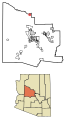
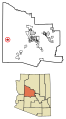
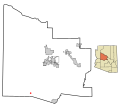
 Map of Arizona highlighting Yavapai County.svg 893 × 1,099; 260 KB
-

-
 AZMap-doton-Big Park.png 260 × 300; 22 KB
-
 AZMap-doton-Cottonwood-Verde Village.png 260 × 300; 22 KB
-
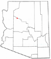
 AZMap-doton-Dewey-Humboldt.png 260 × 300; 22 KB
-
 AZMap-doton-Jerome.png 260 × 300; 22 KB
-
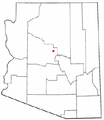 AZMap-doton-Lake Montezuma.png 260 × 300; 22 KB
-
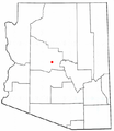
 AZMap-doton-Mayer.png 260 × 300; 22 KB
-
 AZMap-doton-Paulden.png 260 × 300; 22 KB
-
 AZMap-doton-Peeples Valley.png 260 × 300; 22 KB
-
 AZMap-doton-Seligman.png 260 × 300; 22 KB
-
 AZMap-doton-Spring Valley.png 260 × 300; 22 KB
-
 AZMap-doton-Wilhoit.png 260 × 300; 22 KB
-
 AZMap-doton-Williamson.png 260 × 300; 22 KB
-

-
 Derby-mine-highland-pines-thumb-butte-prescott.jpg 2,626 × 1,582; 3.66 MB
-
 Highland pines prescott AZ.jpg 10,623 × 7,969; 21.62 MB
-
 Map of Arizona indicating Yavapai-Apache reservations.svg 893 × 1,099; 258 KB
-

-
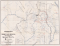
 Mining Districts 1903 Yavapai Prescott Title Co.jpg 1,810 × 1,456; 2.42 MB
-
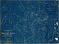
 Prescott Tributary Mining Districts 1895 Jules Baumann.png 1,994 × 1,544; 4.94 MB
-
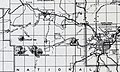
 Sanborn Fire Insurance Map from Jerome, Yavapai County, Arizona. LOC sanborn00158 001-1.jpg 6,510 × 7,680; 3.61 MB
-

-
 Township 14N 3W 1871 ARIZONA Plat 196539 1.jpg 3,568 × 3,304; 9.34 MB
-
 Township 14N 3W 1871 ARIZONA.jpg 3,568 × 3,304; 10.39 MB
-
-
-
-

-

-

-
-

-

-

-

-

-
-

-

-
-

-

-

-

-
-

-

-
-

-
 Yavapai County incorporated areas Ash Fork highlighted.svg 800 × 700; 40 KB
-
 Yavapai County incorporated areas Bagdad highlighted.svg 800 × 700; 40 KB
-
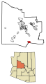
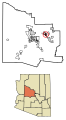
 Yavapai County incorporated areas Big Park highlighted.svg 800 × 700; 40 KB
-
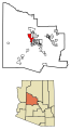
 Yavapai County incorporated areas Black Canyon City highlighted.svg 800 × 700; 40 KB
-
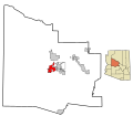
 Yavapai County incorporated areas Camp Verde highlighted.svg 800 × 700; 39 KB
-
 Yavapai County incorporated areas Chino Valley highlighted.svg 800 × 700; 39 KB
-
 Yavapai County incorporated areas Clarkdale highlighted.svg 800 × 700; 39 KB
-
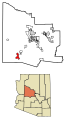
 Yavapai County incorporated areas Congress highlighted.svg 800 × 700; 40 KB
-
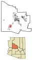
 Yavapai County incorporated areas Cordes Lakes highlighted.svg 800 × 700; 40 KB
-
 Yavapai County incorporated areas Cornville highlighted.svg 800 × 700; 40 KB
-
 Yavapai County incorporated areas Cottonwood highlighted.svg 800 × 700; 39 KB
-

-
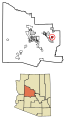
 Yavapai County incorporated areas Dewey-Humboldt highlighted.svg 800 × 700; 39 KB
-
 Yavapai County incorporated areas Jerome highlighted.svg 800 × 700; 40 KB
-
 Yavapai County incorporated areas Lake Montezuma highlighted.svg 800 × 700; 40 KB
-
 Yavapai County incorporated areas Mayer highlighted.svg 800 × 700; 40 KB
-
 Yavapai County incorporated areas Paulden highlighted.svg 800 × 700; 40 KB
-
 Yavapai County incorporated areas Peeples Valley highlighted.svg 800 × 700; 40 KB
-
 Yavapai County incorporated areas Prescott highlighted.svg 800 × 700; 39 KB
-
 Yavapai County incorporated areas Prescott Valley highlighted.svg 800 × 700; 39 KB
-
 Yavapai County incorporated areas Sedona highlighted.svg 800 × 700; 39 KB
-
 Yavapai County incorporated areas Seligman highlighted.svg 800 × 700; 40 KB
-
 Yavapai County incorporated areas Spring Valley highlighted.svg 800 × 700; 40 KB
-
 Yavapai County incorporated areas Wilhoit highlighted.svg 800 × 700; 40 KB
-
 Yavapai County incorporated areas Williamson highlighted.svg 800 × 700; 40 KB
-
 Yavapai County incorporated areas Yarnell highlighted.svg 800 × 700; 40 KB
.jpg)


_Highlighted_0480095.svg)


