Category:Maps of Yotvingia
Jump to navigation
Jump to search
Maps of Yotvingia.
Media in category "Maps of Yotvingia"
The following 10 files are in this category, out of 10 total.
-

-
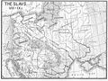
 Die slawische Besiedlung zwischen dem 5. und 7. Jh. n. Chr.jpg 902 × 648; 389 KB
-
 East europe 5-6cc.png 3,935 × 3,033; 344 KB
-
 Mapa prus-pt.svg 751 × 461; 83 KB
-
 Mapa prus.svg 755 × 565; 166 KB
-
 Poland in the 11th century.JPG 912 × 716; 233 KB
-
 Poland under Boleslaw Chrobry.jpg 604 × 384; 83 KB
-
 Slavic peoples 9c map.jpg 776 × 583; 144 KB
-
 Smolensk Historical Museum - 0202.jpg 4,608 × 3,456; 3.35 MB
-
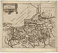 02021 Prussia vetus, Auctore Casp (...) Henneberger.jpg 1,057 × 978; 425 KB
..JPG)


_Henneberger.jpg)