Category:Maps of agriculture in Maine-et-Loire
Jump to navigation
Jump to search
Subcategories
This category has only the following subcategory.
Media in category "Maps of agriculture in Maine-et-Loire"
The following 23 files are in this category, out of 23 total.
-
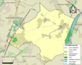 49009-Antoigné-Sols.png 3,270 × 2,598; 1.51 MB
-
 49011-Artannes-sur-Thouet-Sols.png 3,270 × 2,598; 2.15 MB
-
 49053-Brossay-Sols.png 3,270 × 2,598; 1.08 MB
-
 49056-Carbay-Sols.png 3,270 × 2,598; 1.05 MB
-
 49057-Cernusson-Sols.png 3,270 × 2,598; 1.94 MB
-
 49058-Les Cerqueux-Sols.png 3,270 × 2,598; 2.1 MB
-
 49080-Les Hauts-d'Anjou-Sols.png 3,270 × 2,598; 3.74 MB
-
 49089-Chazé-sur-Argos-Sols.png 3,270 × 2,598; 2.36 MB
-
 49121-Dénezé-sous-Doué-Sols.png 3,270 × 2,598; 1.98 MB
-
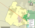
 49123-Distré-Sols.png 3,270 × 2,598; 2.63 MB
-
 49125-Doué-en-Anjou-Sols.png 3,270 × 2,598; 4.96 MB
-
 49178-Loiré-Sols.png 3,270 × 2,598; 2.08 MB
-
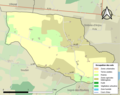
 49215-Montreuil-Bellay-Sols.png 3,270 × 2,598; 2.83 MB
-
 49219-Montsoreau-Sols.png 3,270 × 2,598; 1.66 MB
-
 49236-Passavant-sur-Layon-Sols.png 3,270 × 2,598; 1.38 MB
-
 49272-Saint-Clément-des-Levées-Sols.png 3,270 × 2,598; 2.9 MB
-
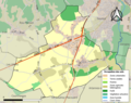
 49291-Saint-Just-sur-Dive-Sols.png 3,270 × 2,598; 1.57 MB
-
 49299-Saint-Léger-sous-Cholet-Sols.png 3,270 × 2,598; 1.9 MB
-
 49302-Saint-Macaire-du-Bois-Sols.png 3,270 × 2,598; 1.48 MB
-
 49343-La Tessoualle-Sols.png 3,270 × 2,598; 2.44 MB
-
 49355-Trémentines-Sols.png 3,270 × 2,598; 2.5 MB
-
 49362-Varrains-Sols.png 3,270 × 2,598; 2.02 MB
-
 49364-Vaudelnay-Sols.png 3,270 × 2,598; 2.58 MB


