Category:Maps of borders of the Dominican Republic
Jump to navigation
Jump to search
Media in category "Maps of borders of the Dominican Republic"
The following 16 files are in this category, out of 16 total.
-
 Caribbean maritime boundaries map zh.svg 3,561 × 2,221; 2.87 MB
-
 Caribbean maritime boundaries map.svg 3,561 × 2,221; 2.78 MB
-
 Caribbean maritime boundaries map mk.svg 3,561 × 2,221; 5.52 MB
-
 Mapa das Caraíbas (fronteiras marítimas).svg 3,561 × 2,221; 2.86 MB
-
 Mapa del Caribe (límites marinos).svg 5,340 × 3,660; 3.02 MB
-
 Mapa del Mar Caribe (límites marinos)-fr.svg 3,587 × 2,221; 1.91 MB
-
 Mapa del Mar Caribe (límites marinos).svg 3,587 × 2,221; 1.98 MB
-
 Colombie-République dominicaine.png 713 × 843; 59 KB
-
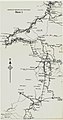
 Dominican Republic - Haiti border map part 1.jpg 1,067 × 3,581; 576 KB
-
 Dominican Republic - Haiti border map part 2.jpg 1,062 × 2,030; 276 KB
-
 Dominican Republic - Haiti border map part 3.jpg 1,058 × 1,639; 251 KB
-
 Dominican Republic - Haiti border map part 4.jpg 1,065 × 2,253; 311 KB
-
 Haiti und Dominikanische Republik - Gebietsentwicklung (mit Gebietszuständen).png 1,893 × 2,647; 621 KB
-
 Hispaniola - Dominican Republic-Haiti Boundary.jpg 948 × 607; 122 KB
-
 Hispaniola pol D2.svg 1,003 × 508; 127 KB
-
 Límites marítimos de Venezuela.png 732 × 558; 22 KB


.svg)
.svg)
-fr.svg)
.svg)


.png)


