Category:Maps of counties of Croatia
Jump to navigation
Jump to search
Subcategories
This category has the following 23 subcategories, out of 23 total.
B
- Maps of Bjelovar-Bilogora County (27 F)
- Maps of Brod-Posavina County (40 F)
D
I
K
- Maps of Karlovac County (52 F)
- Maps of Krapina-Zagorje County (35 F)
L
- Maps of Lika-Senj County (29 F)
M
O
P
- Maps of Požega-Slavonia County (14 F)
S
- Maps of Sisak-Moslavina County (25 F)
V
- Maps of Varaždin County (29 F)
Z
- Maps of Zadar County (74 F)
- Maps of Zagreb County (41 F)
Media in category "Maps of counties of Croatia"
The following 34 files are in this category, out of 34 total.
-
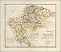 1803 map of Crotia by Karl Joseph Kipferling.jpg 15,846 × 13,464; 24.59 MB
-
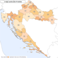 2 digit postcode croatia.png 885 × 885; 77 KB
-
 Chorwacja.png 1,330 × 1,324; 281 KB
-
 City of Zagreb OpenStreetMap.svg 2,333 × 2,579; 38.03 MB
-
 Counties of Croatia 2.png 800 × 774; 168 KB
-
 Counties of Croatia-fr.svg 1,097 × 1,062; 772 KB
-
 Counties of Croatia-mk.svg 1,097 × 1,062; 1.03 MB
-
 Counties of Croatia-numerados.svg 1,097 × 1,062; 669 KB
-
 Counties of Croatia.png 487 × 480; 17 KB
-
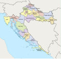
 Counties of Croatia.svg 1,097 × 1,062; 759 KB
-
 Croatia Counties 10th century with Gacka, Krbava, Lika.png 1,097 × 937; 644 KB
-
 Croatia location map-2011-01-02.jpg 1,024 × 991; 275 KB
-
 Croatia map arabic.png 1,096 × 1,057; 232 KB
-
 Croatia transportation.jpg 2,018 × 2,494; 1.77 MB
-
 Croatia-counties-colorkey2.svg 1,097 × 1,062; 742 KB
-
 Croatia-counties-colorkey450px.png 450 × 436; 71 KB
-
 Croatian Counties, Plain Map Colored.svg 600 × 551; 815 KB
-
 Croatian Counties, Plain Map.svg 600 × 551; 820 KB
-
 Croatian counties.png 2,201 × 2,151; 93 KB
-
 Cvelferija.JPG 635 × 597; 34 KB
-
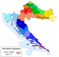
 Hrvatske županije - Counties of Croatia.png 2,201 × 2,151; 168 KB
-
 Koprivnica-Križevci County OpenStreetMap.svg 2,486 × 1,776; 13.13 MB
-
 Krapina-Zagorje County OpenStreetMap.svg 3,030 × 2,033; 61.5 MB
-
 Kroatien - Politische Gliederung (Karte).png 1,460 × 1,170; 363 KB
-
 Kroatien - Politische Gliederung (Karte).svg 701 × 562; 1,008 KB
-
 NUTS of Croatia (2013).png 1,288 × 1,231; 61 KB
-
 NUTS of Croatia.PNG 1,288 × 1,231; 55 KB
-
 Prijedlog zupanijskoga ustroja od 1992-01-31.png 1,547 × 1,569; 68 KB
-
 Regions of Croatia.png 487 × 480; 19 KB
-
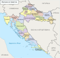
 Statistical-regions-of-Croatia.PNG 2,201 × 2,151; 103 KB
-
 Varaždin County OpenStreetMap.svg 3,196 × 1,859; 29.21 MB
-
 Zupanije Republike Hrvatske od 1992-12-30 do 1997-02-07.png 1,547 × 1,569; 72 KB
-
 Zupanije ru.gif 600 × 600; 157 KB
-
 Zupanije.gif 600 × 600; 373 KB


.png)
.svg)
.png)


