Category:Maps of districts of Georgia
Jump to navigation
Jump to search
Countries of Europe: Albania · Austria · Azerbaijan‡ · Belarus · Georgia‡ · Germany · Kazakhstan‡ · Latvia · Luxembourg · Poland · Portugal‡ · Russia‡ · Serbia · Sweden · United Kingdom
Limited recognition: Abkhazia‡ · Kosovo
‡: partly located in Europe
Limited recognition: Abkhazia‡ · Kosovo
‡: partly located in Europe
Until 2006 Georgia was divided in raions (districts). With local governance reforms, the districts were transformed into (self-governing) municipalities, per 1-1-2006. Most municipalities maintained their old boundaries. Over time some border changes and have taken place. This series of maps is outdated.
Media in category "Maps of districts of Georgia"
The following 71 files are in this category, out of 71 total.
-
 Abasha.png 1,476 × 768; 208 KB
-
 Adigeni.png 1,476 × 768; 208 KB
-
 Akhalgori.png 1,476 × 768; 209 KB
-
 Akhalkalaki and Ninotsminda districts.png 839 × 473; 36 KB
-
 Akhalkalaki.png 1,476 × 768; 210 KB
-
 Akhaltsikhe.png 1,476 × 768; 209 KB
-
 Akhmeta.png 1,476 × 768; 210 KB
-
 Ambrolauri.png 1,476 × 768; 209 KB
-
 Aspindza.png 1,476 × 768; 209 KB
-
 Baghdati.png 1,476 × 768; 209 KB
-
 Bolnisi.png 1,476 × 768; 209 KB
-
 Borjomi.png 1,476 × 768; 209 KB
-
 Chiatura.png 1,476 × 768; 209 KB
-
 Chkhorotsqu.png 1,476 × 768; 209 KB
-
 Chokhatauri.png 1,476 × 768; 197 KB
-
 Dedoplistsqaro.png 1,476 × 768; 209 KB
-
 Dmanisi.png 1,476 × 768; 209 KB
-
 Dusheti.png 1,476 × 768; 210 KB
-
 Dzau.png 1,476 × 768; 209 KB
-
 Gagra.png 1,476 × 768; 208 KB
-
 Gardabani.png 1,476 × 768; 210 KB
-
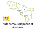 GE-AB-Adm-en.svg 550 × 450; 581 KB
-
 Gori.png 1,476 × 768; 210 KB
-
 Gudauta.png 1,476 × 768; 209 KB
-
 Gulripshi.png 1,476 × 768; 209 KB
-
 Gurjaani.png 1,476 × 768; 209 KB
-
 Kareli.png 1,476 × 768; 209 KB
-
 Kaspi.png 1,476 × 768; 209 KB
-
 Keda.png 1,476 × 768; 208 KB
-
 Kharagauli.png 1,476 × 768; 209 KB
-
 Khashuri.png 1,476 × 768; 208 KB
-
 Khelvachauri.png 1,476 × 768; 208 KB
-
 Khobi.png 1,476 × 768; 209 KB
-
 Khoni.png 1,476 × 768; 208 KB
-
 Khulo.png 1,476 × 768; 209 KB
-
 Kobuleti.png 1,476 × 768; 209 KB
-
 Lagodekhi.png 1,476 × 768; 209 KB
-
 Lanchkhuti.png 1,476 × 768; 200 KB
-
 Lentekhi.png 1,476 × 768; 209 KB
-
 Marneuli.png 1,476 × 768; 209 KB
-
 Martvili.png 1,476 × 768; 209 KB
-
 Mestia.png 1,476 × 768; 209 KB
-
 Mtskheta.png 1,476 × 768; 209 KB
-
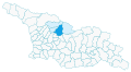 Municipality of Ambrolauri,highlightened region.svg 833 × 456; 2.1 MB
-
 Ninotsminda.png 1,476 × 768; 209 KB
-
 Ochamchire.png 1,476 × 768; 209 KB
-
 Oni.png 1,476 × 768; 209 KB
-
 Ozurgeti.png 1,476 × 768; 200 KB
-
 Poti.png 1,476 × 768; 208 KB
-
 Qazbegi.png 1,476 × 768; 209 KB
-
 Qvareli.png 1,476 × 768; 209 KB
-
 Sachkhere.png 1,476 × 768; 209 KB
-
 Sagarejo.png 1,476 × 768; 209 KB
-
 Samtredia.png 1,476 × 768; 208 KB
-
 Senaki.png 1,476 × 768; 209 KB
-
 Shuakhevi.png 1,476 × 768; 209 KB
-
 Sighnaghi.png 1,476 × 768; 210 KB
-
 Sokhumi.png 1,476 × 768; 209 KB
-
 Tbilisi.png 1,476 × 768; 210 KB
-
 Telavi.png 1,476 × 768; 209 KB
-
 Terjola.png 1,476 × 768; 208 KB
-
 Tetritsqaro.png 1,476 × 768; 209 KB
-
 Tianeti.png 1,476 × 768; 209 KB
-
 Tqibuli.png 1,476 × 768; 208 KB
-
 Tsageri.png 1,476 × 768; 209 KB
-
 Tsalenjikha.png 1,476 × 768; 208 KB
-
 Tsalka.png 1,476 × 768; 209 KB
-
 Tsqaltubo.png 1,476 × 768; 209 KB
-
 Vani.png 1,476 × 768; 208 KB
-
 Zestaponi.png 1,476 × 768; 209 KB
-
 Zugdidi.png 1,476 × 768; 208 KB


