Category:Maps of insular areas of the United States
Jump to navigation
Jump to search
States of the United States: Alabama · Alaska · Arizona · Arkansas · California · Colorado · Connecticut · Delaware · Florida · Georgia · Hawaii · Idaho · Illinois · Indiana · Iowa · Kansas · Kentucky · Louisiana · Maine · Maryland · Massachusetts · Michigan · Minnesota · Mississippi · Missouri · Montana · Nebraska · Nevada · New Hampshire · New Jersey · New Mexico · New York · North Carolina · North Dakota · Ohio · Oklahoma · Oregon · Pennsylvania · Rhode Island · South Carolina · South Dakota · Tennessee · Texas · Utah · Vermont · Virginia · Washington · West Virginia · Wisconsin · Wyoming – Washington, D.C.
insular area of the United States: American Samoa · Guam · Northern Mariana Islands · Puerto Rico · United States Virgin Islands – United States Minor Outlying Islands: Baker Island · Howland Island · Jarvis Island · Johnston Atoll · Kingman Reef · Midway Atoll · Navassa Island · Palmyra Atoll · Wake Island
insular area of the United States: American Samoa · Guam · Northern Mariana Islands · Puerto Rico · United States Virgin Islands – United States Minor Outlying Islands: Baker Island · Howland Island · Jarvis Island · Johnston Atoll · Kingman Reef · Midway Atoll · Navassa Island · Palmyra Atoll · Wake Island
Subcategories
This category has the following 10 subcategories, out of 10 total.
A
G
M
N
P
T
V
Media in category "Maps of insular areas of the United States"
The following 31 files are in this category, out of 31 total.
-
 1967 data of United States - part 1.jpg 4,303 × 2,895; 2.97 MB
-
 Air empire, air freedom (1943).jpg 3,068 × 1,908; 889 KB
-
 Außengebiete der Vereinigten Staaten.png 2,200 × 1,121; 366 KB
-
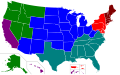
 Blank US Map (states only) 2.svg 958 × 602; 176 KB
-
 Blank USA, w territories 2.svg 958 × 602; 191 KB
-
 Blank USA, w territories.svg 959 × 593; 63 KB
-
 Caribe estadounidense.png 3,472 × 2,048; 253 KB
-
 Chick-fil-A locations in USA.svg 959 × 593; 97 KB
-
 Commonwealth US States.svg 958 × 602; 181 KB
-
 Commonwealths in the USA.svg 958 × 602; 191 KB
-
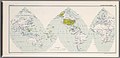
 Map of United States and its Overseas Possessions, 1936.jpg 3,071 × 2,244; 2.41 MB
-
 Map of USA Commonwealths.svg 286 × 186; 169 KB
-
 Minimum wage by state and territory vs federal.svg 958 × 602; 191 KB
-
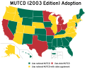 MUTCD (2003-Edition) Adoption.svg 936 × 792; 88 KB
-
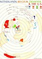 Netherlands, Belgium, Denmark & the U.S., 1954.jpg 1,016 × 1,414; 188 KB
-
 NOAA Map of the US EEZ.svg 612 × 613; 1.93 MB
-
 Regional accreditation map.svg 959 × 593; 37 KB
-
 State RFRA Map.svg 959 × 593; 66 KB
-
 Terytoria zależne Stanów Zjednoczonych.png 2,236 × 1,376; 434 KB
-
 The joint problem, 1940.jpg 1,652 × 2,065; 611 KB
-
 The United States of America 26 (cropped).jpg 5,120 × 2,400; 1.41 MB
-
 The United States of America 26.jpg 5,504 × 2,649; 1.67 MB
-
 US insular areas FAS.png 1,482 × 624; 32 KB
-
 US insular areas-B FAS.png 1,482 × 624; 52 KB
-
 US insular areas-B.png 1,482 × 624; 51 KB
-
 US insular areas.png 1,482 × 624; 39 KB
-
 US minimum wage map.svg 959 × 593; 102 KB
-
 US states and territories 1970x1340.png 1,970 × 1,340; 256 KB
-
 USA Territories 1970.jpg 1,910 × 1,206; 345 KB
-
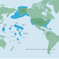
 USAsphere.svg 856 × 433; 2.78 MB
-
 USempire.svg 856 × 433; 2.78 MB

.jpg)


_Adoption.svg)


.jpg)


_2.svg)