Category:Maps of islands of Canada
Jump to navigation
Jump to search
Subcategories
This category has the following 9 subcategories, out of 9 total.
- Maps of the Toronto Islands (2 F)
B
E
- Maps of Ellesmere Island (22 F)
M
- Maps of Victoria Island, Canada (14 F)
N
O
- Maps of Île d'Orléans (16 F)
S
- Maps of Sable Island (17 F)
T
- Maps of the Thousand Islands (9 F)
Media in category "Maps of islands of Canada"
The following 47 files are in this category, out of 47 total.
-
 Adams Island.png 933 × 971; 3.46 MB
-
 AkimiskiCloseup.png 500 × 460; 10 KB
-
 Archipel Hochelaga.PNG 1,063 × 743; 43 KB
-
 Archipel-Hochelaga-île-Jésus.jpg 600 × 420; 42 KB
-
 AxelHeibergIslandCloseupMap.png 499 × 449; 13 KB
-
 BanksIslandCloseup.png 503 × 467; 12 KB
-
 Beaupre Jean Bourdon 1641.PNG 1,750 × 1,243; 840 KB
-
 Canadarcticislands.gif 700 × 675; 117 KB
-
 Canadian Arctic Islands-el.png 727 × 513; 109 KB
-
 CoatsIslandCloseup.png 497 × 331; 7 KB
-
 CornwallisIslandCloseup.png 497 × 574; 16 KB
-
 CornwallIslandCloseup.png 535 × 384; 10 KB
-
 EglintonIslandCloseup.png 534 × 591; 10 KB
-
 Elevator wallpaper at the Fogo Island Inn (32853657897).jpg 3,024 × 4,032; 5.01 MB
-
 EllefRingnesIandneighbourhood.png 500 × 434; 11 KB
-
 FogoIslandCloseupMap.png 542 × 512; 12 KB
-
 GrahamIslandCloseup.png 484 × 580; 13 KB
-
 Griffith Island, Georgian Bay.png 847 × 602; 70 KB
-
 Lake Erie Islands Map.png 1,160 × 814; 47 KB
-
 Lemieux Island OSM.png 1,162 × 692; 252 KB
-
 Mackenzie-King-Borden-Brock-Inseln.jpg 900 × 931; 76 KB
-
-
 Map of Bell Island.png 1,160 × 739; 170 KB
-
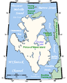
 Map of South Aulatsivik Island.png 788 × 706; 246 KB
-
 MeighenIslandCloseup.png 538 × 527; 11 KB
-
 MelvilleIslandCloseupMap.png 500 × 373; 13 KB
-
 Montreal et Laval.PNG 1,063 × 743; 43 KB
-
 Montréal Métro.PNG 800 × 559; 117 KB
-
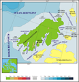
 Ocean Arctic - Localizacion de l'Ila Banks.png 975 × 1,005; 484 KB
-
 Operational Navigation Chart B-7, 5th edition.jpg 9,254 × 6,665; 17 MB
-
 Operational Navigation Chart B-8, 3rd edition.jpg 9,254 × 6,634; 14.14 MB
-
 Operational Navigation Chart C-10, 4th edition.jpg 9,254 × 6,677; 18.68 MB
-
 Operational Navigation Chart C-11, 2nd edition.jpg 9,254 × 6,640; 19.27 MB
-
 Portage-Island Miramichi.jpg 879 × 661; 156 KB
-
 Prince patryk island.png 944 × 975; 281 KB
-
 PrinceofWalesIslandCloseup.png 513 × 632; 20 KB
-
 PrincePatrickIslandCloseup.png 490 × 527; 13 KB
-
 Quarry Island Georgian Bay.svg 800 × 588; 55 KB
-
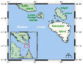 ResolutionIslandMap.png 543 × 417; 13 KB
-
 Southampton Island 1913.jpg 750 × 818; 241 KB
-
 Southampton Island map, 1910, BAGS.jpg 813 × 799; 224 KB
-
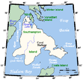 SouthamptonIslandCloseup.png 488 × 476; 14 KB
-
 StefanssonIslandCloseup.png 495 × 353; 9 KB
-
 Wellington Channel Melville Island &c from Admiralty Chart 1862.jpg 2,257 × 1,200; 2.24 MB
-
 Wilkins Strait map he.gif 641 × 381; 64 KB
-
 Île de Montréal.png 800 × 559; 119 KB
-
 Île-Jésus.png 1,060 × 742; 54 KB


.jpg)


_Islands,_northern_Canada.png)


