Category:Maps of local municipalities of the Western Cape
Jump to navigation
Jump to search
Media in category "Maps of local municipalities of the Western Cape"
The following 30 files are in this category, out of 30 total.
-
 Map of the Western Cape with Beaufort West highlighted (2016).svg 849 × 676; 472 KB
-
 Map of the Western Cape with Bergrivier highlighted (2016).svg 849 × 676; 469 KB
-
 Bergrivier LM topographic map.svg 1,198 × 1,011; 8.15 MB
-
 Map of the Western Cape with Bitou highlighted (2016).svg 849 × 676; 463 KB
-
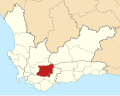
 Map of the Western Cape with Breede Valley highlighted (2016).svg 849 × 676; 461 KB
-
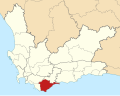 Map of the Western Cape with Cape Agulhas highlighted (2016).svg 849 × 676; 470 KB
-
 Map of the Western Cape with Cederberg highlighted (2016).svg 849 × 676; 471 KB
-
 Cederberg LM topographic map.svg 1,113 × 1,087; 9.7 MB
-
 Map of the Western Cape with Drakenstein highlighted (2016).svg 849 × 676; 465 KB
-
 Map of the Western Cape with George highlighted (2016).svg 849 × 676; 466 KB
-
 Map of the Western Cape with Hessequa highlighted (2016).svg 849 × 676; 477 KB
-
 Map of the Western Cape with Kannaland highlighted (2016).svg 849 × 676; 463 KB
-
 Map of the Western Cape with Knysna highlighted (2016).svg 849 × 676; 461 KB
-
 Map of the Western Cape with Laingsburg highlighted (2016).svg 849 × 676; 467 KB
-
 Map of the Western Cape with Langeberg highlighted (2016).svg 849 × 676; 462 KB
-
 Map of the Western Cape with Matzikama highlighted (2016).svg 849 × 676; 478 KB
-
 Matzikama LM topographic map.svg 956 × 1,268; 8.45 MB
-
 Map of the Western Cape with Mossel Bay highlighted (2016).svg 849 × 676; 470 KB
-
 Map of the Western Cape with Oudtshoorn highlighted (2016).svg 849 × 676; 464 KB
-
 Map of the Western Cape with Overstrand highlighted (2016).svg 849 × 676; 471 KB
-
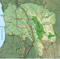
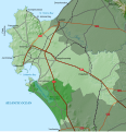
 Overstrand LM topographic map.svg 1,262 × 960; 1.86 MB
-
 Map of the Western Cape with Prince Albert highlighted (2016).svg 849 × 676; 462 KB
-
 Map of the Western Cape with Saldanha Bay highlighted (2016).svg 849 × 676; 475 KB
-
 Saldanha Bay LM topographic map.svg 1,080 × 1,120; 5.22 MB
-
 Map of the Western Cape with Stellenbosch highlighted (2016).svg 849 × 676; 462 KB
-
 Map of the Western Cape with Swartland highlighted (2016).svg 849 × 676; 472 KB
-
 Swartland LM topographic map.svg 1,094 × 1,107; 7.37 MB
-
 Map of the Western Cape with Swellendam highlighted (2016).svg 849 × 676; 469 KB
-
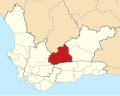
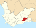
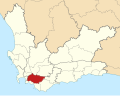 Map of the Western Cape with Theewaterskloof highlighted (2016).svg 849 × 676; 462 KB
-
 Map of the Western Cape with Witzenberg highlighted (2016).svg 849 × 676; 466 KB
.svg)
.svg)

.svg)
.svg)
.svg)
.svg)

.svg)
.svg)
.svg)
.svg)
.svg)
.svg)
.svg)
.svg)

.svg)
.svg)
.svg)

.svg)
.svg)

.svg)
.svg)

.svg)
.svg)
.svg)