Category:Maps of municipalities in the district of Kreuzlingen to 2010
Jump to navigation
Jump to search
Media in category "Maps of municipalities in the district of Kreuzlingen to 2010"
The following 12 files are in this category, out of 12 total.
-
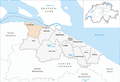
 Karte Gemeinde Altnau 2007.png 1,476 × 1,007; 324 KB
-
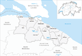
 Karte Gemeinde Bottighofen 2007.png 1,476 × 1,007; 323 KB
-
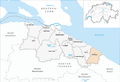
 Karte Gemeinde Ermatingen 2007.png 1,476 × 1,007; 323 KB
-
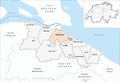
 Karte Gemeinde Gottlieben 2007.png 1,476 × 1,007; 322 KB
-
 Karte Gemeinde Güttingen 2007.png 1,476 × 1,007; 324 KB
-
 Karte Gemeinde Kemmental 2007.png 1,476 × 1,007; 325 KB
-
 Karte Gemeinde Kreuzlingen 2007.png 1,476 × 1,007; 324 KB
-
 Karte Gemeinde Langrickenbach 2007.png 1,476 × 1,007; 324 KB
-
 Karte Gemeinde Lengwil 2007.png 1,476 × 1,007; 325 KB
-
 Karte Gemeinde Münsterlingen 2007.png 1,476 × 1,007; 323 KB
-
 Karte Gemeinde Tägerwilen 2007.png 1,476 × 1,007; 323 KB
-
 Karte Gemeinde Wäldi 2007.png 1,476 × 1,007; 324 KB


